Kreiskarte
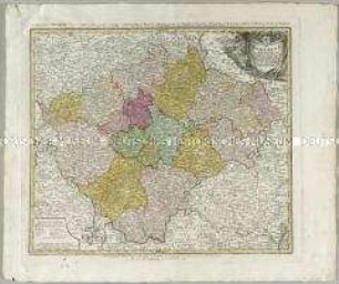
Der Fraenkische Kreis / Charte geographique du Cercle de Franconie
- Alternativer Titel
-
DER / FRAENKISCHE / KREIS / von F. L. Güssefeld
- Standort
-
Deutsches Historisches Museum, Berlin
- Inventarnummer
-
Do 2006/470
- Maße
-
Höhe x Breite: 58,3 x 69 cm (Blatt)
Höhe x Breite: 43,8 x 53,7 cm (Karte)
Höhe x Breite: 48,8 x 57,5 cm (Platte)
- Material/Technik
-
Druckfarbe, Papier, Kupferstich, koloriert
- Klassifikation
-
Kartografie (Gattung)
- Bezug (was)
-
Franken
Fränkischer Reichskreis
- Ereignis
-
Herstellung
- (wer)
-
Kartograf: Franz Ludwig Güssefeld
Stecher: Johann Michael Schmidt
Verlag: Homannsche Erben
- (wo)
-
Nürnberg, Deutschland
- (wann)
-
1782
- Rechteinformation
-
Deutsches Historisches Museum
- Letzte Aktualisierung
- 24.03.2023, 09:30 MEZ
Datenpartner
Dieses Objekt wird bereitgestellt von:
Stiftung Deutsches Historisches Museum. Bei Fragen zum Objekt wenden Sie sich bitte an den Datenpartner.
Stiftung Deutsches Historisches Museum. Bei Fragen zum Objekt wenden Sie sich bitte an den Datenpartner.
Objekttyp
- Kreiskarte
Beteiligte
- Kartograf: Franz Ludwig Güssefeld
- Stecher: Johann Michael Schmidt
- Verlag: Homannsche Erben
Entstanden
- 1782
Ähnliche Objekte (12)
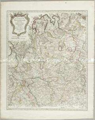
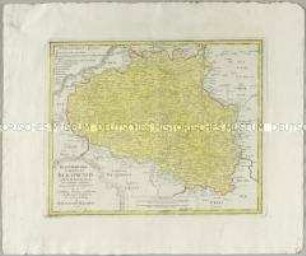
Le Cercle de Westphalie
Atlas Regni Bohemiae: Repraesentatio Geographica Circuli Egerani, nec non Elnbogensis / Carte du Territoire d'Egra, & du Cercle d'Elnbogue
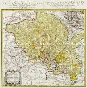
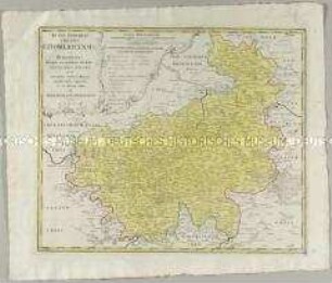
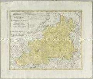
Geographische Verzeichnung des Budissinischen Creises in dem Marggrafthum Ober Lausitz
Atlas Regni Bohemiae: Die Gegend um Prag / Les Environs de Prague
Atlas Regni Bohemiae: Regni Bohemiae Circulus Beraunensis
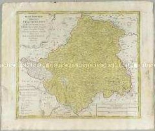
Atlas Regni Bohemiae: Regni Bohemiae Circulus Litomericensis
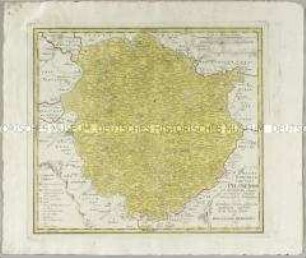
Atlas Regni Bohemiae: Regni Bohemiae Circulus Prachinensis
Atlas Regni Bohemiae: Regni Bohemiae Circulus Pilsnensis
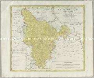
Atlas Regni Bohemiae: Regni Bohemiae Circulus Kaurzimensis
Atlas regni Bohemiae: Bohemiae Regnum in XII. Circulos divisum
Atlas Regni Bohemiae: Regni Bohemiae Circulus Rakonicensis
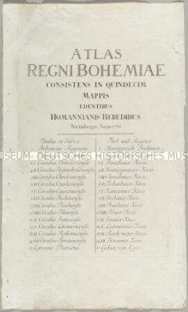
Atlas Regni Bohemiae
Le Cercle de Westphalie
Atlas Regni Bohemiae: Repraesentatio Geographica Circuli Egerani, nec non Elnbogensis / Carte du Territoire d'Egra, & du Cercle d'Elnbogue
Geographische Verzeichnung des Budissinischen Creises in dem Marggrafthum Ober Lausitz
Atlas Regni Bohemiae: Die Gegend um Prag / Les Environs de Prague
Atlas Regni Bohemiae: Regni Bohemiae Circulus Beraunensis
Atlas Regni Bohemiae: Regni Bohemiae Circulus Litomericensis
Atlas Regni Bohemiae: Regni Bohemiae Circulus Prachinensis
Atlas Regni Bohemiae: Regni Bohemiae Circulus Pilsnensis
Atlas Regni Bohemiae: Regni Bohemiae Circulus Kaurzimensis
Atlas regni Bohemiae: Bohemiae Regnum in XII. Circulos divisum
Atlas Regni Bohemiae: Regni Bohemiae Circulus Rakonicensis