- Archivaliensignatur
-
RW Karten, 9542
- Maße
-
Höhe: 46 cm , Breite: 49 cm , Maßstab: 1: 25 000
- Kontext
-
RW Karten >> 1. Topographische Karten >> 1.4. Noch zuzuordnen
- Bestand
-
RW Karten
- Laufzeit
-
1895
- Weitere Objektseiten
- Provenienz
-
Diverse Registraturbildner
- Geliefert über
- Letzte Aktualisierung
- 09.01.2026, 11:35 MEZ
Datenpartner
Dieses Objekt wird bereitgestellt von:
Landesarchiv Nordrhein-Westfalen. Abteilung Rheinland. Bei Fragen zum Objekt wenden Sie sich bitte an den Datenpartner.
Landesarchiv Nordrhein-Westfalen. Abteilung Rheinland. Bei Fragen zum Objekt wenden Sie sich bitte an den Datenpartner.
Objekttyp
- Karten / Pläne
Entstanden
- 1895
Ähnliche Objekte (12)

Blatt 3030 Stolberg b. Aachen, neu: 5203
Blatt 3030 Stolberg b. Aachen, neu: 5203
Blatt 3030 Stolberg b. Aachen, neu: 5203
Blatt 3030 Stolberg b. Aachen, neu: 5203
Blatt 3030 Stolberg b. Aachen, neu: 5203
5203 (alte Nr.: 3030) Stolberg

5203 (alte Nr.: 3030) Stolberg
3030

Nr. 3030

Nr. 3030
3030 Suhlendorf
![[5203], 3030 Stolberg 50°42'-23°50' F. Ausgabe: [Preußische Landesaufnahme].](https://iiif.deutsche-digitale-bibliothek.de/image/2/ef19becd-bb8b-4b84-b61d-d47d158bb18b/full/!306,450/0/default.jpg)
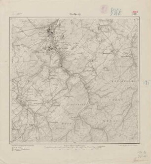
[5203], 3030 Stolberg 50°42'-23°50' F. Ausgabe: [Preußische Landesaufnahme].
Blatt 3030 Stolberg b. Aachen, neu: 5203
Blatt 3030 Stolberg b. Aachen, neu: 5203
Blatt 3030 Stolberg b. Aachen, neu: 5203
Blatt 3030 Stolberg b. Aachen, neu: 5203
Blatt 3030 Stolberg b. Aachen, neu: 5203
5203 (alte Nr.: 3030) Stolberg
5203 (alte Nr.: 3030) Stolberg
3030
Nr. 3030
Nr. 3030
3030 Suhlendorf