- Alternative title
-
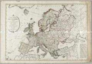
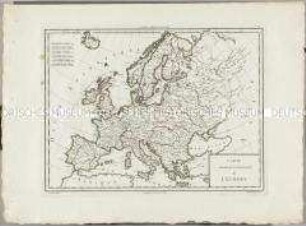
CARTE GÉNÉRALE DE TOUTE / L'EUROPE, / DIVISÉE SELON L'ETENDUE DE SES PRINCIPAUX / ETATS,
- Location
-
Deutsches Historisches Museum, Berlin
- Inventory number
-
Do 2006/1006.1-6
- Measurements
-
Höhe x Breite: 70 x 59 cm (Blatt 1)
Höhe x Breite: 52,5 x 43,4 cm (Karte 1)
Höhe x Breite: 55,5 x 45,5 cm (Platte 1)
- Material/Technique
-
Papier, Kupferstich, koloriert
- Classification
-
Kartografie (Gattung)
- Subject (what)
-
Europa
- Event
-
Herstellung
- (who)
-
Stecher, Verleger, Geograph: Tobias Konrad Lotter
Stecher, Verleger: Matthäus Albrecht Lotter
- (where)
-
Augsburg, Deutschland
- (when)
-
1782
- Rights
-
Deutsches Historisches Museum
- Last update
- 24.03.2023, 9:31 AM CET
Data provider
This object is provided by:
Stiftung Deutsches Historisches Museum. If you have any questions about the object, please contact the data provider.
Stiftung Deutsches Historisches Museum. If you have any questions about the object, please contact the data provider.
Object type
- Kontinentalkarte
Associated
- Stecher, Verleger, Geograph: Tobias Konrad Lotter
- Stecher, Verleger: Matthäus Albrecht Lotter
Time of origin
- 1782
Other Objects (12)

Carte Genèrale de toute l'Europe

Carte Générale de toute l'Europe
Carte Générale de l'Europe
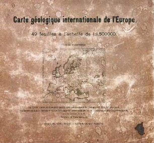
Carte géologique internationale de l'Europe
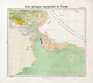
Carte géologique internationale de l'Europe
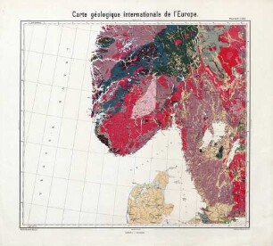
Carte géologique internationale de l'Europe

Carte géologique internationale de l'Europe
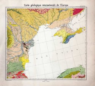
Carte géologique internationale de l'Europe
![Plan général de répuplicaniser toute l´Europe [Generalplan zur Republikanisierung von ganz Europa]](/assets/placeholder/searchResultMediaNoDigitisedMedia.png)
Plan général de répuplicaniser toute l´Europe [Generalplan zur Republikanisierung von ganz Europa]
Atlas Nouveau: Carte Générale et Politique de l'Europe

Carte politique, hydrographique & routiere de l'Europe

Carte Physique Et Politique de L'Europe
Carte Genèrale de toute l'Europe
Carte Générale de toute l'Europe
Carte Générale de l'Europe
Carte géologique internationale de l'Europe
Carte géologique internationale de l'Europe
Carte géologique internationale de l'Europe
Carte géologique internationale de l'Europe
Carte géologique internationale de l'Europe
Plan général de répuplicaniser toute l´Europe [Generalplan zur Republikanisierung von ganz Europa]
Atlas Nouveau: Carte Générale et Politique de l'Europe
Carte politique, hydrographique & routiere de l'Europe