- Alternativer Titel
-
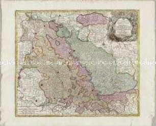
L'ECOSSE / divisée en / SHIRES ou COMTÉS, / PAR LE SR. ROBERT
- Standort
-
Deutsches Historisches Museum, Berlin
- Inventarnummer
-
Do 2006/872
- Maße
-
Höhe x Breite: 55 x 78 cm (Blatt)
Höhe x Breite: 46,7 x 54,6 cm (Karte)
Höhe x Breite: 49,5 x 57,5 cm (Platte)
- Material/Technik
-
Papier, Kupferstich, grenzkoloriert
- Klassifikation
-
Kartografie (Gattung)
- Bezug (was)
-
Schottland
- Ereignis
-
Herstellung
- (wer)
-
Kartograf, Geograph: Didier Robert de Vaugondy
Stecher, Kartograf: Paolo Santini
Kartograf: Giuseppe Antonio Remondini
- (wo)
-
Venedig, Italien
- (wann)
-
um 1778
- Rechteinformation
-
Deutsches Historisches Museum
- Letzte Aktualisierung
- 24.03.2023, 09:29 MEZ
Datenpartner
Dieses Objekt wird bereitgestellt von:
Stiftung Deutsches Historisches Museum. Bei Fragen zum Objekt wenden Sie sich bitte an den Datenpartner.
Stiftung Deutsches Historisches Museum. Bei Fragen zum Objekt wenden Sie sich bitte an den Datenpartner.
Objekttyp
- Verwaltungskarte
Beteiligte
- Kartograf, Geograph: Didier Robert de Vaugondy
- Stecher, Kartograf: Paolo Santini
- Kartograf: Giuseppe Antonio Remondini
Entstanden
- um 1778
Ähnliche Objekte (12)
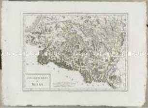
Atlas Nouveau: Gouvernement de Bearn
![Karte von Hessen (südliche Nassauische Fürstentümer), 1:350 000, Kupferstich, um 1740 : Moguntini Archiepiscopat' et Electoratus : nec non Comitatuum Utriusque Cattimeliboci Verthemensis, & Erpachiensis aliarumque insertarum & adjacentium Regionum accuratißima Descriptio : cum Privil. Ordin. General. Belgii Foederati / per Nic. Visscher, Nunc apud Petr. Schenk Iunior, G. Gouwen s.. - [Ca. 1:350 000] (E 007 30 -E 009 44 /N 050 32 -N 049 17). - Amst. Bat. : Petr. Schenk Iunior , [um 1740]. - 1 Karte : Kupferstich ; 46 x 58 cm, Blattgröße 54 x 63 cm. - Nullmeridian:St. Miguel. - Titelkartusche geschmückt mit Wappen u. allegor. Darst. oben rechts. - Erklärungs- u. Maßstabskartusche geschmückt mit allegor. Darst. unten links. - Stecher in Titelkartusche unten](https://iiif.deutsche-digitale-bibliothek.de/image/2/406bf9f8-e0ab-4859-8cbb-848d71e95444/full/!306,450/0/default.jpg)
Karte von Hessen (südliche Nassauische Fürstentümer), 1:350 000, Kupferstich, um 1740 : Moguntini Archiepiscopat' et Electoratus : nec non Comitatuum Utriusque Cattimeliboci Verthemensis, & Erpachiensis aliarumque insertarum & adjacentium Regionum accuratißima Descriptio : cum Privil. Ordin. General. Belgii Foederati / per Nic. Visscher, Nunc apud Petr. Schenk Iunior, G. Gouwen s.. - [Ca. 1:350 000] (E 007 30 -E 009 44 /N 050 32 -N 049 17). - Amst. Bat. : Petr. Schenk Iunior , [um 1740]. - 1 Karte : Kupferstich ; 46 x 58 cm, Blattgröße 54 x 63 cm. - Nullmeridian:St. Miguel. - Titelkartusche geschmückt mit Wappen u. allegor. Darst. oben rechts. - Erklärungs- u. Maßstabskartusche geschmückt mit allegor. Darst. unten links. - Stecher in Titelkartusche unten
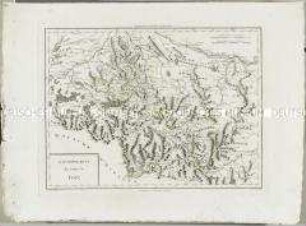
Atlas Nouveau: Gouvernement du Comté de Foix

Topographische Karte der Gegend östlich von Emmendingen zwischen Dörlinbach, Prechtal, Elzach, Triberg, Furtwangen, St. Peter und Freiburg im Breisgau, heute Südlicher Oberrhein und Regierungsbezirk Freiburg
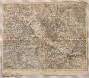
Topographische Karte des Elbetals und Umgebung nordwestlich von Dresden in Sachsen
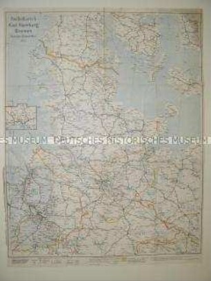
Administrative Karte von Norddeutschland mit den Postleitgebieten
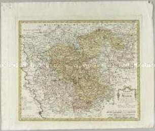
Charte von der Grafschaft Mark
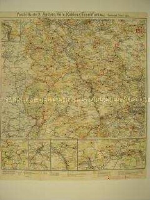
Verwaltungskarte mit den Postleitgebieten Aachen, Köln, Koblenz, Frankfurt/Main
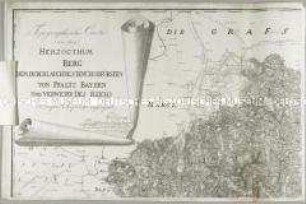
Topographische Carte von dem Herzogthum Berg. Mit einer Anschlusskarte: Ertzstift Cöln; einer Nebenkarte: Topographische Karte der Rhein-Gegend von der Aar-Mündung bis Blittersdorf; und einem Erläuterungsblatt
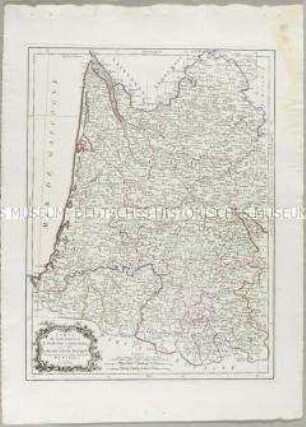
Carte du Gouvernement de Guyenne et Gascogne

Verwaltungskarte der DDR (Wandkarte)
Mappa Geographica continens Archiepiscopatum et Electoratum Coloniensem
Atlas Nouveau: Gouvernement de Bearn
Karte von Hessen (südliche Nassauische Fürstentümer), 1:350 000, Kupferstich, um 1740 : Moguntini Archiepiscopat' et Electoratus : nec non Comitatuum Utriusque Cattimeliboci Verthemensis, & Erpachiensis aliarumque insertarum & adjacentium Regionum accuratißima Descriptio : cum Privil. Ordin. General. Belgii Foederati / per Nic. Visscher, Nunc apud Petr. Schenk Iunior, G. Gouwen s.. - [Ca. 1:350 000] (E 007 30 -E 009 44 /N 050 32 -N 049 17). - Amst. Bat. : Petr. Schenk Iunior , [um 1740]. - 1 Karte : Kupferstich ; 46 x 58 cm, Blattgröße 54 x 63 cm. - Nullmeridian:St. Miguel. - Titelkartusche geschmückt mit Wappen u. allegor. Darst. oben rechts. - Erklärungs- u. Maßstabskartusche geschmückt mit allegor. Darst. unten links. - Stecher in Titelkartusche unten
Atlas Nouveau: Gouvernement du Comté de Foix
Topographische Karte der Gegend östlich von Emmendingen zwischen Dörlinbach, Prechtal, Elzach, Triberg, Furtwangen, St. Peter und Freiburg im Breisgau, heute Südlicher Oberrhein und Regierungsbezirk Freiburg
Topographische Karte des Elbetals und Umgebung nordwestlich von Dresden in Sachsen
Administrative Karte von Norddeutschland mit den Postleitgebieten
Charte von der Grafschaft Mark
Verwaltungskarte mit den Postleitgebieten Aachen, Köln, Koblenz, Frankfurt/Main
Topographische Carte von dem Herzogthum Berg. Mit einer Anschlusskarte: Ertzstift Cöln; einer Nebenkarte: Topographische Karte der Rhein-Gegend von der Aar-Mündung bis Blittersdorf; und einem Erläuterungsblatt
Carte du Gouvernement de Guyenne et Gascogne
Verwaltungskarte der DDR (Wandkarte)