- Alternativer Titel
-
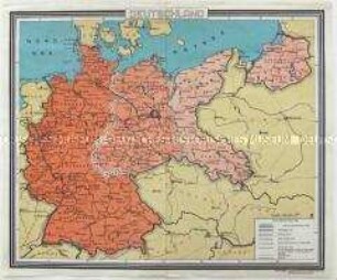
Die Schlachten in Polen und Galizien
- Standort
-
Deutsches Historisches Museum, Berlin
- Inventarnummer
-
Do 78/38.1I
- Maße
-
Höhe x Breite: 34,6 x 40,8 cm
- Material/Technik
-
Papier, gedruckt
- Klassifikation
-
Kartografie (Gattung)
- Bezug (was)
-
Weltkrieg, 1.
- Ereignis
-
Herstellung
- (wer)
-
Kartograf: H. Stegemann
Herausgeber: Geogr. Institut Kümmerly und Frey
- (wo)
-
Deutschland [historisch: Deutsches Reich]
- (wann)
-
um 1930
- Rechteinformation
-
Deutsches Historisches Museum
- Letzte Aktualisierung
- 24.03.2023, 09:27 MEZ
Datenpartner
Dieses Objekt wird bereitgestellt von:
Stiftung Deutsches Historisches Museum. Bei Fragen zum Objekt wenden Sie sich bitte an den Datenpartner.
Stiftung Deutsches Historisches Museum. Bei Fragen zum Objekt wenden Sie sich bitte an den Datenpartner.
Objekttyp
- Historische Karte
Beteiligte
- Kartograf: H. Stegemann
- Herausgeber: Geogr. Institut Kümmerly und Frey
Entstanden
- um 1930
Ähnliche Objekte (12)

Historische Karte zum 1. Weltkrieg (Beilage aus den "Kriegserinnerungen" von Ludendorff)

Historische Karte zur Schlacht bei Tannenberg aus: Der Weltkrieg 1914-1918, Zweiter Band

Historische Karte zur Schlacht bei Tannenberg aus: Der Weltkrieg 1914-1918, Zweiter Band

Historische Karte zur Schlacht bei Tannenberg aus: Der Weltkrieg 1914-1918, Zweiter Band

Historische Karte zum 1. Weltkrieg (Beilage aus dem Buch "Meine Kriegserinnerungen" von Ludendorff)

Historische Wandkarte aus der UdSSR zum 1. Weltkrieg

Historisch-politische Karte mit den Wirkungsstätten Ernst Thälmanns

Historische Karte zum Deutsch-Französischen Krieg 1870/71
Historische Karte Deutschlands in den Grenzen von 1937
Fotokopie einer historischen Karte mit dem Grundriss der Stadt Köln im Mittelalter
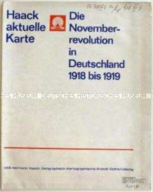
Historische Karte zur Novemberrevolution und den revolutionären Kämpfen in Deutschland 1918/19
Vierteilige historische Karte aus der UdSSR zum Verlauf der Revolution 1917/18
Historische Karte zum 1. Weltkrieg (Beilage aus den "Kriegserinnerungen" von Ludendorff)
Historische Karte zur Schlacht bei Tannenberg aus: Der Weltkrieg 1914-1918, Zweiter Band
Historische Karte zur Schlacht bei Tannenberg aus: Der Weltkrieg 1914-1918, Zweiter Band
Historische Karte zur Schlacht bei Tannenberg aus: Der Weltkrieg 1914-1918, Zweiter Band
Historische Karte zum 1. Weltkrieg (Beilage aus dem Buch "Meine Kriegserinnerungen" von Ludendorff)
Historische Wandkarte aus der UdSSR zum 1. Weltkrieg
Historisch-politische Karte mit den Wirkungsstätten Ernst Thälmanns
Historische Karte zum Deutsch-Französischen Krieg 1870/71
Historische Karte Deutschlands in den Grenzen von 1937
Fotokopie einer historischen Karte mit dem Grundriss der Stadt Köln im Mittelalter
Historische Karte zur Novemberrevolution und den revolutionären Kämpfen in Deutschland 1918/19