Band
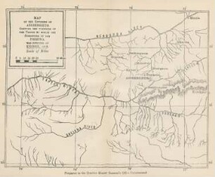
sheet 3d: Being a map of the country included in the angle formed by the river Tigris & the upper Zab : shewing the disposition of the various ancient sites in the vicinity of Nineveh

- Location
-
Universitäts- und Landesbibliothek Sachsen-Anhalt -- Altkt L I [10] Oa 2385 2° (3)
- Extent
-
1 Karte; 118 x 64 cm, Stich
- Language
-
Englisch
- Notes
-
"To the first patron of Assyrian research His Excellency the right Honble. the Viscount Stratford de Radcliffe, G.C.B. ambassador extraordinary and plenipotentiary to the Sublime Ottoman Porte this map of Central Assyria is ... respectfully dedicated."
- Bibliographic citation
-
As an accompaniment to the 1st. and 2nd. sheets of the Vestiges of Assuria
- Contributor
- Published
-
[London] : published by John Walker, geographer to the Honble. East India Company , 1855
- Sponsorship
-
Die Digitalisierung wurde gefördert durch die Deutsche Digitale Bibliothek aus Mitteln des Programms „Neustart Kultur“ der Beauftragten der Bundesregierung für Kultur und Medien.
- DOI
-
doi:10.25673/62474
- URN
-
urn:nbn:de:gbv:3:3-1192015415-068402139-18
- Last update
- 03.06.2025, 7:51 AM CEST
Data provider
This object is provided by:
Martin-Luther-Universität Halle-Wittenberg, Universitäts- und Landesbibliothek Sachsen-Anhalt. If you have any questions about the object, please contact the data provider.
Martin-Luther-Universität Halle-Wittenberg, Universitäts- und Landesbibliothek Sachsen-Anhalt. If you have any questions about the object, please contact the data provider.
Object type
- Band
Time of origin
- [London] : published by John Walker, geographer to the Honble. East India Company , 1855
Other Objects (12)

Plan of the Pnyx and the Vicinity
The tectonic stress in the vicinity of the Alps
Map of the environs of Asseerghur shewing the positions of the troops ...

Shewing the figure - Dress of 1829

Notes on the mineralogy of part of the vicinity of Dublin

The Caves in the Vicinity of Karle and the Bor Ghat

Lagrangian Modeling in the vicinity of the Eastfrisian Islands
Dynamics in the Vicinity of the Stable Halo Orbits

Sect. XLIII. Of the state of the upper Duab, and the vicinity of Delhi.
Right out of the gate: the genomics of Lessepsian invaders in the vicinity of the Suez Canal
On the solar origin of interplanetary disturbances observed in the vicinity of the Earth
Synthetic Photometry Experiments in the Vicinity of the Paschen Jump
Plan of the Pnyx and the Vicinity
The tectonic stress in the vicinity of the Alps
Map of the environs of Asseerghur shewing the positions of the troops ...
Shewing the figure - Dress of 1829
Notes on the mineralogy of part of the vicinity of Dublin
The Caves in the Vicinity of Karle and the Bor Ghat
Lagrangian Modeling in the vicinity of the Eastfrisian Islands
Dynamics in the Vicinity of the Stable Halo Orbits
Sect. XLIII. Of the state of the upper Duab, and the vicinity of Delhi.
Right out of the gate: the genomics of Lessepsian invaders in the vicinity of the Suez Canal
On the solar origin of interplanetary disturbances observed in the vicinity of the Earth