Karten und Pläne
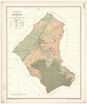
Handris über die auf Gemarkung Oos zu enteignenden Grundstücke
Lageplan wie Nr. 3, Grundstücke verschiedenfarbig gezeichnet.
- Reference number
-
Abt. Generallandesarchiv Karlsruhe, H Oos 4
- Dimensions
-
64 x 81 (Höhe x Breite)
- Further information
-
Ausführung: Druck
Orientierung: NW
Originalmaßstab: 1:1 500
- Context
-
Gemarkungspläne >> Badische Orte >> O >> Oos, Stkr. Baden-Baden
- Holding
-
Landesarchiv Baden-Württemberg, Abt. Generallandesarchiv Karlsruhe, H Gemarkungspläne
- Creator
-
Autor/Fotograf: ?
- Other object pages
- View digital item at providers-website
- Rights
-
Es gelten die Nutzungsbedingungen des Landesarchivs Baden-Württemberg.
- Last update
-
04.04.2025, 8:15 AM CEST
Data provider
This object is provided by:
Landesarchiv Baden-Württemberg. If you have any questions about the object, please contact the data provider.
Landesarchiv Baden-Württemberg. If you have any questions about the object, please contact the data provider.
Object type
- Karten und Pläne
Associated
- Autor/Fotograf: ?
Other Objects (12)

Handriß über die auf Gemarkung Oos zu enteignenden Grundstücke

Lageplan über die zu enteignenden Grundstücke an der Bahnstrecke auf Gemarkung Friedrichsfeld bis zur Gemarkung Edingen
Verzeichnis der zu enteignenden Grundstücke
Verzeichnis der zu enteignenden Grundstücke
Verzeichnis der zu enteignenden Grundstücke
Verzeichnis der zu enteignenden Grundstücke
Verzeichnis der zu enteignenden Grundstücke
Situationsplan der zur Anlegung der Chaponstraße in Dessau zu enteignenden Flächen
Oos (Stkr. Baden-Baden)
Strecke Halle - Nordhausen. Lageplan zu den für Schneeschutzanlagen zu enteignenden Flächen in der Gemarkung Erdeborn
Postamt Baden-Baden 12, Oos
Verzeichnisse der auf der Gemarkung Beiertheim zu enteignenden Grundstücke
Handriß über die auf Gemarkung Oos zu enteignenden Grundstücke
Lageplan über die zu enteignenden Grundstücke an der Bahnstrecke auf Gemarkung Friedrichsfeld bis zur Gemarkung Edingen
Verzeichnis der zu enteignenden Grundstücke
Verzeichnis der zu enteignenden Grundstücke
Verzeichnis der zu enteignenden Grundstücke
Verzeichnis der zu enteignenden Grundstücke
Verzeichnis der zu enteignenden Grundstücke
Situationsplan der zur Anlegung der Chaponstraße in Dessau zu enteignenden Flächen
Oos (Stkr. Baden-Baden)
Strecke Halle - Nordhausen. Lageplan zu den für Schneeschutzanlagen zu enteignenden Flächen in der Gemarkung Erdeborn
Postamt Baden-Baden 12, Oos