- Reference number
-
D 73, 5/7412
- Dimensions
-
Höhe: 55, Breite: 93, Maßstab: 1 : 2500
- Notes
-
Weitere Teile verzeichnet unter Sign. 5/449; 5/7411; 5/7413.
- Context
-
Allgemeine Kartensammlung (VERA-Verzeichnung) >> 1. Allgemeine Sammlung >> 1.3. Flurkarten
- Holding
-
D 73 Allgemeine Kartensammlung (VERA-Verzeichnung)
- Date of creation
-
1929
- Other object pages
- Provenance
-
Hunke, Heinrich
- Delivered via
- Last update
-
05.11.2025, 3:17 PM CET
Data provider
This object is provided by:
Landesarchiv Nordrhein-Westfalen. Abteilung Ostwestfalen-Lippe. If you have any questions about the object, please contact the data provider.
Landesarchiv Nordrhein-Westfalen. Abteilung Ostwestfalen-Lippe. If you have any questions about the object, please contact the data provider.
Object type
- Karten / Pläne
Time of origin
- 1929
Other Objects (12)

Grundbesitz des v.d.Horstschen Gutes, später v. Bethmann-Hollweg
Grundbesitz des v.d.Horstschen Gutes, später v. Bethmann-Hollweg

Bethmann-Hollweg
Bethmann-Hollweg.
Bethmann-Hollweg
Bethmann-Hollweg, Theobald
Kriegsziele: Bethmann-Hollweg

Von Bethmann-Hollweg

Aug. Bethmann-Hollweg.
Bethmann-Hollweg, Felix von
Theodor von Bethmann-Hollweg
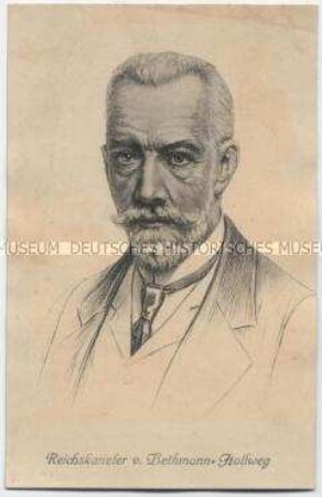
Reichskanzler von Bethmann-Hollweg
Grundbesitz des v.d.Horstschen Gutes, später v. Bethmann-Hollweg
Grundbesitz des v.d.Horstschen Gutes, später v. Bethmann-Hollweg
Bethmann-Hollweg
Bethmann-Hollweg.
Bethmann-Hollweg
Bethmann-Hollweg, Theobald
Kriegsziele: Bethmann-Hollweg
Von Bethmann-Hollweg
Aug. Bethmann-Hollweg.
Bethmann-Hollweg, Felix von
Theodor von Bethmann-Hollweg