Karte/Plan
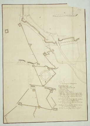
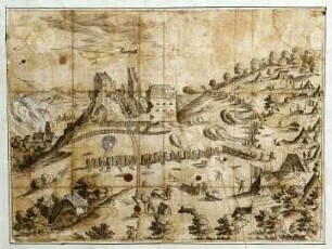
WHK 1 Einzelne kriegerische Vorfälle: Belagerung von Cartagena durch die englische Flotte
- Archivaliensignatur
-
WHK 1/60
- Maße
-
578 x 485 mm
- Sonstige Erschließungsangaben
-
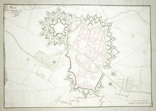
Identifikation (Karte/Plan): Originaltitel: This Plan of the Harbour, Town and Several Forts of Cartagena. In which is Exhibited a Perfect View of the English Fleet as they Ancored all along the Coast, in the Bay, near the Town; and also after they moved and laid under the Forts oft St. Jago uand St. Philipe, and at the Boca-chica or Mouth of the Harbour: Likewise of the English Ships as they moved in different parts in the Harbour, on order to lay Siege to the Town.
Weitere Angaben (Karte/Plan): Maßstab: 3 Furlongs = 11,6 cm [1:40.000]
Weitere Angaben (Karte/Plan): Ausführung: Handzeichnung, farbig
Weitere Angaben (Karte/Plan): Blattzahl: 1
- Kontext
-
Wilhelmshöher Kriegskarten >> Einzelne Kriege und Schlachtordnungen >> WHK 1 Einzelne kriegerische Vorfälle
- Bestand
-
WHK Wilhelmshöher Kriegskarten
- Urheber
-
T. Kohlhardt
- Laufzeit
-
[1770-1790]
- Weitere Objektseiten
- Letzte Aktualisierung
-
10.06.2025, 09:13 MESZ
Datenpartner
Dieses Objekt wird bereitgestellt von:
Hessisches Staatsarchiv Marburg. Bei Fragen zum Objekt wenden Sie sich bitte an den Datenpartner.
Hessisches Staatsarchiv Marburg. Bei Fragen zum Objekt wenden Sie sich bitte an den Datenpartner.
Objekttyp
- Karte/Plan
Beteiligte
- T. Kohlhardt
Entstanden
- [1770-1790]
Ähnliche Objekte (12)

WHK 1 Einzelne kriegerische Vorfälle: Belagerung von Cartagena durch die englische Flotte
WHK 1 Einzelne kriegerische Vorfälle: Index zu "Einzelne kriegerische Vorfälle"
WHK 1 Einzelne kriegerische Vorfälle: Angriff von Courtrai
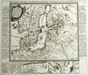
WHK 1 Einzelne kriegerische Vorfälle: Kriegsschauplätze zwischen den russischen und schwedischen Armeen und Flotten, 1788
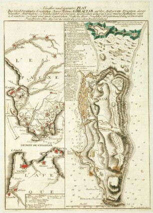
WHK 1 Einzelne kriegerische Vorfälle: Belagerung von Gibraltar, 1779
WHK 1 Einzelne kriegerische Vorfälle: Belagerung von Braunschweig, 1671
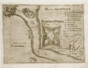
WHK 1 Einzelne kriegerische Vorfälle: Schlacht um Rügen, 1678
WHK 1 Einzelne kriegerische Vorfälle: Angriff auf Gerona, 1684
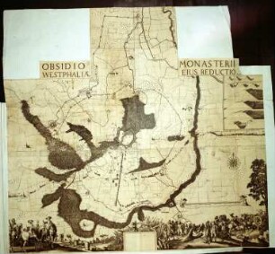
WHK 1 Einzelne kriegerische Vorfälle: Belagerung von Münster, 1661
WHK 1 Einzelne kriegerische Vorfälle: Belagerung von Landstuhl, 1523
WHK 1 Einzelne kriegerische Vorfälle: Belagerung von Luxemburg, 1684
WHK 1 Einzelne kriegerische Vorfälle: Belagerung von Guilliers, 1610
WHK 1 Einzelne kriegerische Vorfälle: Belagerung von Cartagena durch die englische Flotte
WHK 1 Einzelne kriegerische Vorfälle: Index zu "Einzelne kriegerische Vorfälle"
WHK 1 Einzelne kriegerische Vorfälle: Angriff von Courtrai
WHK 1 Einzelne kriegerische Vorfälle: Kriegsschauplätze zwischen den russischen und schwedischen Armeen und Flotten, 1788
WHK 1 Einzelne kriegerische Vorfälle: Belagerung von Gibraltar, 1779
WHK 1 Einzelne kriegerische Vorfälle: Belagerung von Braunschweig, 1671
WHK 1 Einzelne kriegerische Vorfälle: Schlacht um Rügen, 1678
WHK 1 Einzelne kriegerische Vorfälle: Angriff auf Gerona, 1684
WHK 1 Einzelne kriegerische Vorfälle: Belagerung von Münster, 1661
WHK 1 Einzelne kriegerische Vorfälle: Belagerung von Landstuhl, 1523
WHK 1 Einzelne kriegerische Vorfälle: Belagerung von Luxemburg, 1684