- Location
-
München, Bayerische Staatsbibliothek -- Mapp. XII,5 c
- Dimensions
-
77 x 57 cm, gefaltet
- Extent
-
1 Kt.
- Language
-
Deutsch
- Notes
-
mehrfarb.
Mit 1 Nebenkt.: Kiel und Umgebung
- Bibliographic citation
-
Carl Flemmings Generalkarten ; 13
- Series
-
Carl Flemmings Generalkarten; 13
- Keyword
-
Karte
Insel
Nordschleswig
Nordwestdeutschland
Schleswig-Holstein
Mecklenburg-Schwerin
Dänemark
- Event
-
Veröffentlichung
- (where)
-
Berlin u.a.
- (who)
-
Flemming
- (when)
-
s.a. [ca. 1900]
- Contributor
- URN
-
urn:nbn:de:bvb:12-bsb00082133-1
- Last update
-
27.11.2025, 8:38 AM CET
Data provider
This object is provided by:
Bayerische Staatsbibliothek. If you have any questions about the object, please contact the data provider.
Bayerische Staatsbibliothek. If you have any questions about the object, please contact the data provider.
Object type
- kartografisches Bild
Associated
- Handtke, Friedrich (Sonstige)
- Flemming
Time of origin
- s.a. [ca. 1900]
Other Objects (12)

Flemmings Übersichtskarte für den europäischen Kriegsschauplatz
![Troppau [Reymann's Topographische Special-Karte von Deutschland und den angrenzenden Staaten]](https://iiif.deutsche-digitale-bibliothek.de/image/2/204a1e7b-60e8-4d1f-867b-65a2de52c600/full/!306,450/0/default.jpg)
Troppau [Reymann's Topographische Special-Karte von Deutschland und den angrenzenden Staaten]
![[Franckfurth] [Reymann's Topographische Special-Karte von Deutschland und den angrenzenden Staaten]](https://iiif.deutsche-digitale-bibliothek.de/image/2/7c8969df-e741-42b1-b5be-0357423b60fb/full/!306,450/0/default.jpg)
[Franckfurth] [Reymann's Topographische Special-Karte von Deutschland und den angrenzenden Staaten]
General Karte Vom Europäischen Russland und den kaukasischen Ländern

Flemmings Karte der neuen Staatenbildungen im Osten und des russischen Kriegsgebiets zwischen Ostsee und Schwarzem Meer

Provinz Brandenburg

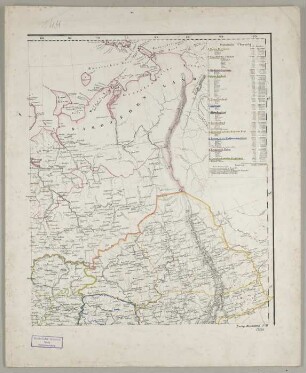
West-Kurland, Litauen und Ostpreussen
![Die Schiffsversenkungen unserer U-Boote nach Lage und Zahl dargest. auf Grund amtl. Materials mit Seeschlachten, Sperrgebieten, Landfronten, Land-Gewinn u. -Verlust : [Mit 1 Nebenkt. ; Mit e. Begleittext]](/assets/placeholder/searchResultMediaUnknown.png)
Die Schiffsversenkungen unserer U-Boote nach Lage und Zahl dargest. auf Grund amtl. Materials mit Seeschlachten, Sperrgebieten, Landfronten, Land-Gewinn u. -Verlust : [Mit 1 Nebenkt. ; Mit e. Begleittext]
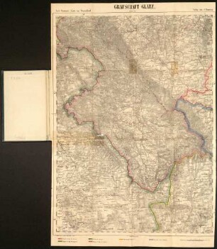
Grafschaft Glatz

Karte von Deutsch-Südwestafrika : Mit 4 Nebenkt. ; Übersicht d. Schiffsverb. ; Beziehungen zum Kaplande ; Lagepplan von Swakopmund , prov. Brandenburg zum Vergl. d. Grössenverhältn.
![G. D. Reymann's topographische Special-Karte von Central-Europa, 201 = [450]. Würzburg](https://iiif.deutsche-digitale-bibliothek.de/image/2/433d6d4f-525c-4a1a-a5d0-b974ab9f9695/full/!306,450/0/default.jpg)
G. D. Reymann's topographische Special-Karte von Central-Europa, 201 = [450]. Würzburg

G. D. Reymann's topographische Special-Karte von Central-Europa, 240. Eichstädt
Flemmings Übersichtskarte für den europäischen Kriegsschauplatz
Troppau [Reymann's Topographische Special-Karte von Deutschland und den angrenzenden Staaten]
[Franckfurth] [Reymann's Topographische Special-Karte von Deutschland und den angrenzenden Staaten]
General Karte Vom Europäischen Russland und den kaukasischen Ländern
Flemmings Karte der neuen Staatenbildungen im Osten und des russischen Kriegsgebiets zwischen Ostsee und Schwarzem Meer
Provinz Brandenburg
West-Kurland, Litauen und Ostpreussen
Die Schiffsversenkungen unserer U-Boote nach Lage und Zahl dargest. auf Grund amtl. Materials mit Seeschlachten, Sperrgebieten, Landfronten, Land-Gewinn u. -Verlust : [Mit 1 Nebenkt. ; Mit e. Begleittext]
Grafschaft Glatz
Karte von Deutsch-Südwestafrika : Mit 4 Nebenkt. ; Übersicht d. Schiffsverb. ; Beziehungen zum Kaplande ; Lagepplan von Swakopmund , prov. Brandenburg zum Vergl. d. Grössenverhältn.
G. D. Reymann's topographische Special-Karte von Central-Europa, 201 = [450]. Würzburg