- Alternative title
-
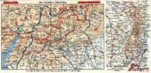
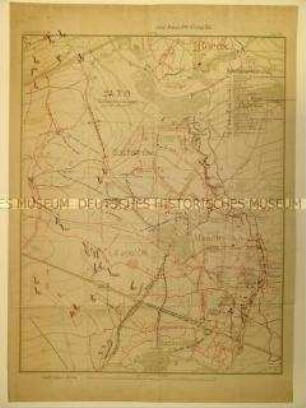
Die Westfront mit Westwall und Maginotlinie
- Location
-
Deutsches Historisches Museum, Berlin
- Inventory number
-
Do2 98/630
- Measurements
-
Höhe x Breite: 24 x 20,2 cm (geschlossen), Höhe x Breite: 60 x 47,8 cm
- Material/Technique
-
Papier, gedruckt
- Classification
-
Karten, Pläne, Risse (Gattung)
- Subject (what)
-
Weltkrieg, 2.
Westfront
- Event
-
Herstellung
- (who)
-
Druckerei: Meissner und Buch
- (where)
-
Deutschland [historisch: Deutsches Reich]
- (when)
-
1939
- Rights
-
Deutsches Historisches Museum
- Last update
-
24.03.2023, 9:28 AM CET
Data provider
This object is provided by:
Stiftung Deutsches Historisches Museum. If you have any questions about the object, please contact the data provider.
Stiftung Deutsches Historisches Museum. If you have any questions about the object, please contact the data provider.
Object type
- Militärstrategische Karte
Associated
- Druckerei: Meissner und Buch
Time of origin
- 1939
Other Objects (12)
Militärstrategische Karte von der Westfront
Militärstrategische Karten von der Westfront, Juni 1915
Militärstrategische Karte der Westfront vom September 1917

Militär-strategische Karte von der Westfront zum Kriegsbeginn 1914
Militärstrategische Karte zur Kriegslage an der Westfront im September 1914 ("Marneschlacht")
Militärstrategische Karte vom westlichen Kriegsschauplatz
Militär-strategische Karte von Groß-Britannien
Militär-strategische Karte von Groß-Britannien
Militärstrategische Karte eines Frontabschnittes in Frankreich
Militärstrategische Karte eines Frontabschnittes in Frankreich
Militärstrategische Karte des Kampfgebietes in Frankreich
Militär-strategische Karte des Pazifik-Raumes
Militärstrategische Karte von der Westfront
Militärstrategische Karten von der Westfront, Juni 1915
Militärstrategische Karte der Westfront vom September 1917
Militär-strategische Karte von der Westfront zum Kriegsbeginn 1914
Militärstrategische Karte zur Kriegslage an der Westfront im September 1914 ("Marneschlacht")
Militärstrategische Karte vom westlichen Kriegsschauplatz
Militär-strategische Karte von Groß-Britannien
Militär-strategische Karte von Groß-Britannien
Militärstrategische Karte eines Frontabschnittes in Frankreich
Militärstrategische Karte eines Frontabschnittes in Frankreich
Militärstrategische Karte des Kampfgebietes in Frankreich