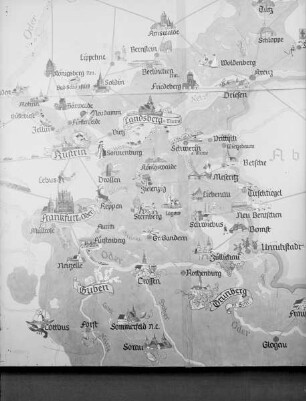
Die Karte der mittleren Freiluftanomalien für Gradabteilungen 6'× 10' von Westdeutschland
- Location
-
Deutsche Nationalbibliothek Frankfurt am Main
- Dimensions
-
4
- Extent
-
17 S.
- Language
-
Deutsch
- Notes
-
1 Kt. in Rückenschlaufe
- Bibliographic citation
-
Mitteilung des Instituts für Angewandte Geodäsie / Institut für Angewandte Geodäsie ; Nr. 32
[Veröffentlichungen] ; H. Nr. 46, T. 2
- Event
-
Veröffentlichung
- (where)
-
Frankfurt a.M.
- (who)
-
Verl. d. Instituts f. Angewandte Geodäsie
- (when)
-
1959
- Creator
-
Gerke, Karl
Watermann, Heinz
- Table of contents
- Rights
-
Bei diesem Objekt liegt nur das Inhaltsverzeichnis digital vor. Der Zugriff darauf ist unbeschränkt möglich.
- Last update
-
11.06.2025, 1:49 PM CEST
Data provider
This object is provided by:
Deutsche Nationalbibliothek. If you have any questions about the object, please contact the data provider.
Deutsche Nationalbibliothek. If you have any questions about the object, please contact the data provider.
Associated
- Gerke, Karl
- Watermann, Heinz
- Verl. d. Instituts f. Angewandte Geodäsie
Time of origin
- 1959
Other Objects (12)

Die Äxte und Beile im mittleren Westdeutschland, 1.
Die Äxte und Beile im mittleren Westdeutschland, 2
Karte des mittleren Erzgebirges [Mappentitel: Amtliche Karte des mittleren Erzgebirges
Übersichtskarten der Schwere und der mittleren Höhen von Westdeutschland
Karte des mittleren Erzgebirges
Waldbauliche Untersuchungen über die Weisstanne im nördlichen und mittleren Westdeutschland

Die spätbronze- und urnenfelderzeitlichen Bronzemesser im mittleren und südlichen Westdeutschland
"Redende" Karte der mittleren Ostmark
Entwicklungsperioden agrarer Siedlungsgebiete im mittleren Westdeutschland seit dem frühen 13. Jahrhundert
Karte des mittleren Wolnzacher Jagdbogens; Handzeichnung
Karte des mittleren Wolnzacher Jagdbogens; Handzeichnung
Karte 2. Karte der nördlichen und mittleren Argonnen.
Die Äxte und Beile im mittleren Westdeutschland, 1.
Die Äxte und Beile im mittleren Westdeutschland, 2
Karte des mittleren Erzgebirges [Mappentitel: Amtliche Karte des mittleren Erzgebirges
Übersichtskarten der Schwere und der mittleren Höhen von Westdeutschland
Karte des mittleren Erzgebirges
Waldbauliche Untersuchungen über die Weisstanne im nördlichen und mittleren Westdeutschland
Die spätbronze- und urnenfelderzeitlichen Bronzemesser im mittleren und südlichen Westdeutschland
"Redende" Karte der mittleren Ostmark
Entwicklungsperioden agrarer Siedlungsgebiete im mittleren Westdeutschland seit dem frühen 13. Jahrhundert
Karte des mittleren Wolnzacher Jagdbogens; Handzeichnung
Karte des mittleren Wolnzacher Jagdbogens; Handzeichnung