- Reference number
-
5-1-0 Plankammer, 5-1-0-2119.0000
- Dimensions
-
891 x 702
- Formal description
-
Plan zur historischen Entwicklung von Kaiserswerth; acht Einzelbildkarten zu den Stadtentwicklungsphasen 1141 bis 1810; ohne Jahresangabe.
- Material
-
Papier
- Further information
-
Ausführung: Druck; farbig
Maßstab: o.A.
- Context
-
Plankammer >> Bürgermeisterei Kaiserswerth (bis zur Eingemeindung 1929) >> Thematische Karten
- Holding
-
5-1-0 Plankammer Plankammer
- Indexentry person
- Date of creation
-
(1141 - 1810), 1981
- Other object pages
- Provenance
-
thematische Karten
- Delivered via
- Last update
-
05.11.2025, 3:51 PM CET
Data provider
This object is provided by:
Stadtarchiv Düsseldorf. If you have any questions about the object, please contact the data provider.
Stadtarchiv Düsseldorf. If you have any questions about the object, please contact the data provider.
Object type
- Karten und Pläne
Time of origin
- (1141 - 1810), 1981
Other Objects (12)

Kaiserswerth: Stadtbildanalyse des Historischen Kerns. Aufstellung eines Denkmalpflegeplans.
Beihilfen für Instandsetzungen der historischen Profanbauten in Düsseldorf- Kaiserswerth
Verzeichnis der Historischen Pläne
Historischer Rundgang Kaiserswerth
Allgemeines zur historischen Entwicklung
Motorschiff "Kaiserswerth", Pläne
Zur historischen Entwicklung der Logistik
Zur historischen Entwicklung geburtshilflicher Instrumente
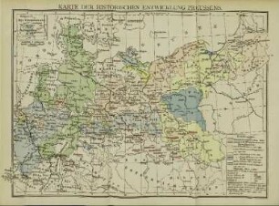
Karte der historischen Entwicklung Preussens
![[Plan der Festung Kaiserswerth].](https://iiif.deutsche-digitale-bibliothek.de/image/2/c22136e4-5a47-4e4a-9511-4b54059c06cd/full/!306,450/0/default.jpg)
[Plan der Festung Kaiserswerth].
Königsberg in historischen Ansichten und Plänen
Dokumentensammlung zur historischen Entwicklung des Forschungsrates
Kaiserswerth: Stadtbildanalyse des Historischen Kerns. Aufstellung eines Denkmalpflegeplans.
Beihilfen für Instandsetzungen der historischen Profanbauten in Düsseldorf- Kaiserswerth
Verzeichnis der Historischen Pläne
Historischer Rundgang Kaiserswerth
Allgemeines zur historischen Entwicklung
Motorschiff "Kaiserswerth", Pläne
Zur historischen Entwicklung der Logistik
Zur historischen Entwicklung geburtshilflicher Instrumente
Karte der historischen Entwicklung Preussens
[Plan der Festung Kaiserswerth].
Königsberg in historischen Ansichten und Plänen