Karte / Plan
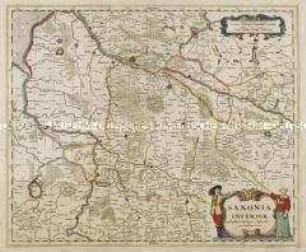
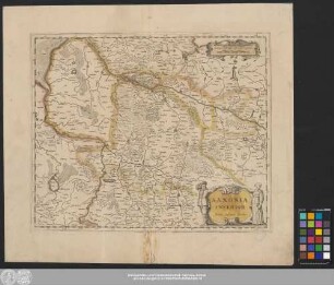
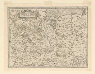
Niedersachsen, Topographie und Territorien: Saxonia Inferior. Johannes Janßonius Excudit
- Former reference number
-
Bibliothek Harff-Dreiborn, Landkarten Nr. 138
- Dimensions
-
Höhe: 38 cm, Breite: 46 cm, Maßstab: 1: 10 000
- Context
-
RW Karten >> 1. Topographische Karten >> 1.4. Noch zuzuordnen
- Holding
-
RW Karten
- Date of creation
-
[17. Jh.]
- Other object pages
- Provenance
-
Diverse Registraturbildner
- Delivered via
- Last update
-
05.11.2025, 4:03 PM CET
Data provider
This object is provided by:
Landesarchiv Nordrhein-Westfalen. Abteilung Rheinland. If you have any questions about the object, please contact the data provider.
Landesarchiv Nordrhein-Westfalen. Abteilung Rheinland. If you have any questions about the object, please contact the data provider.
Object type
- Karten / Pläne
Time of origin
- [17. Jh.]
Other Objects (12)
Saxonia Inferior

Saxonia Inferior.
Saxonia Inferior

COMITATVS WERTHEIMICI FINITIMARVMOVE REGIONVM NOVA ET EXACTA DESCRIPTIO. Joannes Janssonius excudit
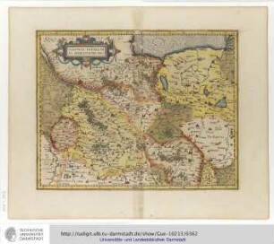
Saxonia Inferior Et Meklenborg Dvc.
Saxonia Inferior Et Meklenborg Duc.
Saxonia Inferior et Meklenborg ducatus
COMITATVS WERTHEIMICI FINITIMARVMOVE REGIONVM NOVA ET EXACTA DESCRIPTIO. Joannes Janssonius excudit (Kupferstich)
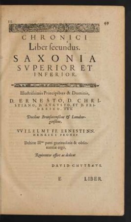
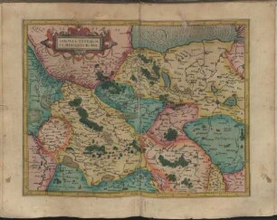
Chronici Liber secundus. Saxonia Superior Et Inferior.

Saxonia Inferior Et Meklenborg Dvcatvs : Cum Privilegio
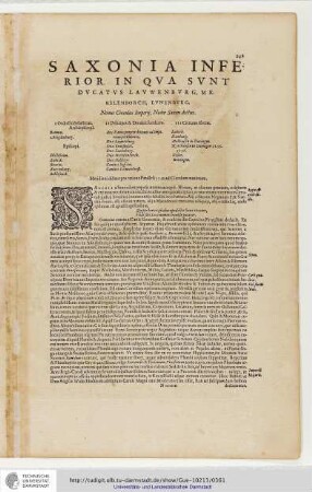
Saxonia Inferior. In Qua sunt Ducatus Lauwenburg, Mecklenborch, Lunenburg.

Fossa quae a Rheno ad Mosam duci coepta est Anno CIƆ IƆC XXVII. Excudit Guilj(elmus) Janßonius Blaeuw
Saxonia Inferior
Saxonia Inferior.
Saxonia Inferior
COMITATVS WERTHEIMICI FINITIMARVMOVE REGIONVM NOVA ET EXACTA DESCRIPTIO. Joannes Janssonius excudit
Saxonia Inferior Et Meklenborg Dvc.
Saxonia Inferior Et Meklenborg Duc.
Saxonia Inferior et Meklenborg ducatus
COMITATVS WERTHEIMICI FINITIMARVMOVE REGIONVM NOVA ET EXACTA DESCRIPTIO. Joannes Janssonius excudit (Kupferstich)
Chronici Liber secundus. Saxonia Superior Et Inferior.
Saxonia Inferior Et Meklenborg Dvcatvs : Cum Privilegio
Saxonia Inferior. In Qua sunt Ducatus Lauwenburg, Mecklenborch, Lunenburg.