Karten und Pläne
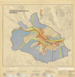
Nachbarschaftsverband Karlsruhe Flächennutzungsplan
Flächennutzungsplan des Nachbarschaftsverbandes Karlsruhe, 2. Entwurf. Mit Legende. 2. Teil, nördlicher Teil der Stadt mit Umgebung, Rhein, Wöschbach, Weingarten, Staffort bis Linkenheim-Hochstetten, Spöck. Bebaute Flächen grün usw. Erläuterung in der Legende.
- Reference number
-
Abt. Generallandesarchiv Karlsruhe, H Karlsruhe 157, 2
- Dimensions
-
88 x 109 (Höhe x Breite)
- Further information
-
Ausführung: Druck
Orientierung: ?
Originalmaßstab: 1:25 000
- Context
-
Gemarkungspläne >> Badische Orte >> K >> Karlsruhe, Stkr.
- Holding
-
Landesarchiv Baden-Württemberg, Abt. Generallandesarchiv Karlsruhe, H Gemarkungspläne
- Creator
-
Autor/Fotograf: ?
- Date of creation
-
1983
- Other object pages
- Rights
-
Es gelten die Nutzungsbedingungen des Landesarchivs Baden-Württemberg.
- Last update
-
04.04.2025, 8:06 AM CEST
Data provider
This object is provided by:
Landesarchiv Baden-Württemberg. If you have any questions about the object, please contact the data provider.
Landesarchiv Baden-Württemberg. If you have any questions about the object, please contact the data provider.
Object type
- Karten und Pläne
Associated
- Autor/Fotograf: ?
Time of origin
- 1983
Other Objects (12)

Nachbarschaftsverband Karlsruhe Flächennutzungsplan
Nachbarschaftsverband Karlsruhe Flächennutzungsplan Entwurf 1982
Flächennutzungsplan Ebenheid
Flächennutzungsplan Ebenheid
Flächennutzungsplan Seelbach
Flächennutzungsplan Freudenberg
Flächennutzungsplan Freudenberg
Flächennutzungsplan Freudenberg
Flächennutzungsplan Neunkirchen
Flächennutzungsplan 1979
Flächennutzungsplan Freudenberg
Flächennutzungsplan Freudenberg
Nachbarschaftsverband Karlsruhe Flächennutzungsplan
Nachbarschaftsverband Karlsruhe Flächennutzungsplan Entwurf 1982
Flächennutzungsplan Ebenheid
Flächennutzungsplan Ebenheid
Flächennutzungsplan Seelbach
Flächennutzungsplan Freudenberg
Flächennutzungsplan Freudenberg
Flächennutzungsplan Freudenberg
Flächennutzungsplan Neunkirchen
Flächennutzungsplan 1979
Flächennutzungsplan Freudenberg