- Alternative title
-
Geographia
Geographica enarratio
Geographicae enarrationes
Claudii Ptolemaei Geographicae Enarrationis Libri Octo
Claudi Ptolemaei Geographicae Enarrationis Libri Octo
Index Ptolemaei Copiosvs Admodvm
Index Ptolemaei Copiosus Admodum
- Location
-
München, Bayerische Staatsbibliothek -- ESlg/2 A.gr.b. 991
- VD16
-
VD16 P 5211
- Dimensions
-
2°
- Extent
-
82, [48] Bl., 49 Doppeltaf.
- Language
-
Latein
- Notes
-
Ill. (Holzschn.), Kt.
Bibliographischer Nachweis: Ritter 1959
Erscheinungsvermerk im Kolophon (Bl. [14]: Argentoragi, Iohannes Grieningerus, communibus Iohannis Koberger impensis excudebat. Anno ... M.D.XXV. Tertio Kal. Apriles
Gliederung der Karten: Tabula Europae I - X (= Nr. 1 - 10), Tabula Aphricae I - IV (= Nr. 11 - 14), Tabula Asiae I - XII (= Nr. 15 - 26) , Tabula Nova/Moderna (= Nr. 28 - 49)), sowie eine Karte mit den Titel "Orbis Typus Universalis Iuxta Hydrographorum Traditionem" (= Nr. 50) und eine Weltkarte (Generale Ptholemei) ohne Titel (gilt als Nr. 27)
Holzschnitt mit der Armillarsphäre von Albrecht Dürer (Rücks. von Bl. 69). - Nach Bl. 69 folgt Bl. 70 ungezählt und dann 2 mal die Zählung als Bl. 72
Enth. außerdem: Index Ptolemaei Copiosvs Admodvm, Nec Sntea Visvs Cum explanatione loco[rum] ... Adnexa sunt ... viginti Neotericorum tabulae ...
- Keyword
-
Ptolemaeus, Claudius
Geografie
Kartografie
Altertum
Griechisch
Atlas
Osteuropa
Alte Welt
- Event
-
Veröffentlichung
- (where)
-
Argentoragi
- (who)
-
Grieninger
- (when)
-
1525
- Event
-
Veröffentlichung
- (where)
-
[Nürnberg]
- (who)
-
Koberger
- (when)
-
1525
- Creator
- Contributor
- URN
-
urn:nbn:de:bvb:12-bsb00078294-4
- Last update
-
27.11.2025, 8:40 AM CET
Data provider
This object is provided by:
Bayerische Staatsbibliothek. If you have any questions about the object, please contact the data provider.
Bayerische Staatsbibliothek. If you have any questions about the object, please contact the data provider.
Object type
- Text
- kartografisches Bild
Associated
Time of origin
- 1525
Other Objects (12)

Clavdii Ptolemaei Alexandrini Geographicae Enarationis Libri Octo
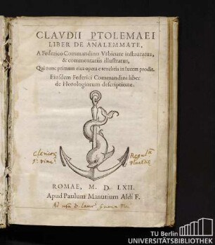
Clavdii Ptolemaei Liber De Analemmate

Claudii Ptolemaei Pelusiensis Libri Quatuor de Astrorum Iudiciis

Fol. 1 ff. Ptolemaei libri IV mathematicae : e translatione Wintomiensis Ebdelmessiae

Fol. 104 ff. Ptolemaei almagesti libri VI : "Parvum almagesti Ptolemei demonstratum per Campanum de primis sex libris"
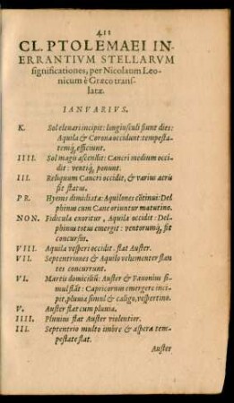
Cl. Ptolemaei Inerrantium Stellarum significationes ...
![Co[n]sertatio haud inelegans Culsameri Lutheriani et F. Bartolom. Usinge[n] theologiae co[n]sulti augustiniani ...](https://iiif.deutsche-digitale-bibliothek.de/image/2/ca0e9c42-69ce-408b-b48b-22116f48a914/full/!306,450/0/default.jpg)
Co[n]sertatio haud inelegans Culsameri Lutheriani et F. Bartolom. Usinge[n] theologiae co[n]sulti augustiniani ...

Ptolemaei libri IV mathematicae translatione Wintomiensis Ebdelmessiae - Mscr.Dresd.Db.87
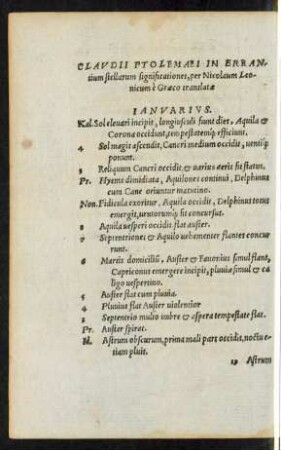
Claudii Ptolemaei In Errantium stellarum significationes, per Nicolaum Leonicum e Graeco translatae.
![Almagest (Exzerpt) [13]](https://iiif.deutsche-digitale-bibliothek.de/image/2/54d56883-f6c7-46db-906b-6c619c67eaf7/full/!306,450/0/default.jpg)
Almagest (Exzerpt) [13]
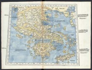
Griechenland nach Ptolemäus, Holzstich, um 150 n.C., Ausgabe von 1482 : Griechenland / Claudius Ptolemäus. - 1:1 800 000. - 1 Karte : Holzschnitt ; 54 x 41 cm. aus Ptolemaeus, Claudius : Cosmographia / (Übers.: Jacobus Angelus. Ed: Nicolaus Germanus). - Ulm : Lienhart Holle , 1482 ; 2°
![Karte von Mexico, 1:19 000 000, Kupferstich, 1574 : Nveva Hispania Tabvla Nova. - [Ca. 1:19 000 000] - [Venetia] : [Giordano Ziletti] , [1574]. - 1 Kt. : Kupferst. ; 23 x 17 cm](https://iiif.deutsche-digitale-bibliothek.de/image/2/295c9bed-56b9-4698-9e43-638c4e42f64d/full/!306,450/0/default.jpg)
Karte von Mexico, 1:19 000 000, Kupferstich, 1574 : Nveva Hispania Tabvla Nova. - [Ca. 1:19 000 000] - [Venetia] : [Giordano Ziletti] , [1574]. - 1 Kt. : Kupferst. ; 23 x 17 cm
Clavdii Ptolemaei Alexandrini Geographicae Enarationis Libri Octo
Clavdii Ptolemaei Liber De Analemmate
Claudii Ptolemaei Pelusiensis Libri Quatuor de Astrorum Iudiciis
Fol. 1 ff. Ptolemaei libri IV mathematicae : e translatione Wintomiensis Ebdelmessiae
Fol. 104 ff. Ptolemaei almagesti libri VI : "Parvum almagesti Ptolemei demonstratum per Campanum de primis sex libris"
Cl. Ptolemaei Inerrantium Stellarum significationes ...
Co[n]sertatio haud inelegans Culsameri Lutheriani et F. Bartolom. Usinge[n] theologiae co[n]sulti augustiniani ...
Ptolemaei libri IV mathematicae translatione Wintomiensis Ebdelmessiae - Mscr.Dresd.Db.87
Claudii Ptolemaei In Errantium stellarum significationes, per Nicolaum Leonicum e Graeco translatae.
Almagest (Exzerpt) [13]
Griechenland nach Ptolemäus, Holzstich, um 150 n.C., Ausgabe von 1482 : Griechenland / Claudius Ptolemäus. - 1:1 800 000. - 1 Karte : Holzschnitt ; 54 x 41 cm. aus Ptolemaeus, Claudius : Cosmographia / (Übers.: Jacobus Angelus. Ed: Nicolaus Germanus). - Ulm : Lienhart Holle , 1482 ; 2°