Karte / Plan
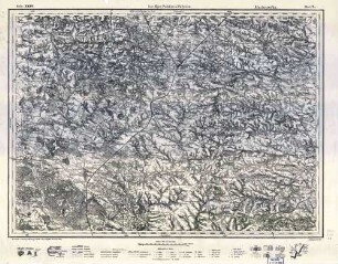
Schiffbarmachung der Ruhr von Mülheim bis Witten. Bl. 46: Flußquerschnitte [St. 23,0 + 40 - 24,7 + 80 = km 24,7 - 26,5 + 10]. Havestadt und Contag, kgl. Bauräte, Berlin. Zg. No. 14009 v. 14.10.1913
- Reference number
-
RW Karten, 4089
- Dimensions
-
Höhe: 105 cm, Breite: 71 cm, Maßstab: 1 : 200
- Context
-
RW Karten >> 5. Gewässer >> 5.3. Ruhr >> 5.3.4. Schiffbarmachung
- Holding
-
RW Karten
- Date of creation
-
1913
- Other object pages
- Provenance
-
Diverse Registraturbildner
- Delivered via
- Last update
-
05.11.2025, 3:18 PM CET
Data provider
This object is provided by:
Landesarchiv Nordrhein-Westfalen. Abteilung Rheinland. If you have any questions about the object, please contact the data provider.
Landesarchiv Nordrhein-Westfalen. Abteilung Rheinland. If you have any questions about the object, please contact the data provider.
Object type
- Karten / Pläne
Time of origin
- 1913
Other Objects (12)
24_7 Machnowka

24/7: Wasserfahrzeuge

24/7: Wasserfahrzeuge

24:7 Zeitmanagement
Arbeitsgr. 24/7
24,7. Rechnungen, Quittungen
24/7 time management
Auftragsbestätigungen, Bd. 24/7
Hostel Fl. 24/7

Schiffbarmachung der Ruhr von Mülheim bis Witten Bl. 37: Normalquerschnitte. Havestadt und Contag, Berlin, kgl. Bauräte. Zg. No. 14000 v. 14.10.1913

Luftbild: Film 24 Bildnr. 247

24/7 - The Passion of Life
24_7 Machnowka
24/7: Wasserfahrzeuge
24/7: Wasserfahrzeuge
24:7 Zeitmanagement
Arbeitsgr. 24/7
24,7. Rechnungen, Quittungen
24/7 time management
Auftragsbestätigungen, Bd. 24/7
Hostel Fl. 24/7
Schiffbarmachung der Ruhr von Mülheim bis Witten Bl. 37: Normalquerschnitte. Havestadt und Contag, Berlin, kgl. Bauräte. Zg. No. 14000 v. 14.10.1913
Luftbild: Film 24 Bildnr. 247