Karte / Plan
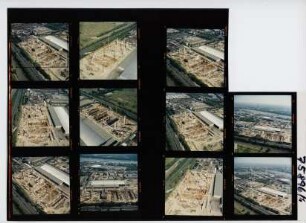
[Rheinbauarbeiten bei Niehl und Teile der Flittarder ("Flittorfer") Insel]
- Former reference number
-
I 22b, Nr. 34
- Dimensions
-
Höhe: 68 cm, Breite: 47 cm, Maßstab: [ca. 1 : 540]
- Notes
-
Unbeschädigt. Doppelstück von 2325
- Context
-
RW Karten >> 5. Gewässer >> 5.2. Rhein >> 5.2.2. Kürzere Stromabschnitte
- Holding
-
RW Karten
- Date of creation
-
[nach 1775]
- Other object pages
- Provenance
-
Diverse Registraturbildner
- Delivered via
- Last update
-
05.11.2025, 4:18 PM CET
Data provider
This object is provided by:
Landesarchiv Nordrhein-Westfalen. Abteilung Rheinland. If you have any questions about the object, please contact the data provider.
Landesarchiv Nordrhein-Westfalen. Abteilung Rheinland. If you have any questions about the object, please contact the data provider.
Object type
- Karten / Pläne
Time of origin
- [nach 1775]
Other Objects (12)
![[Rheinbauarbeiten bei Niehl und Teile der Flittarder ("Flittorfer") Insel]. I 22a / 33](https://iiif.deutsche-digitale-bibliothek.de/image/2/f6c9ffd0-221b-461a-beca-6de656752397/full/!306,450/0/default.jpg)
[Rheinbauarbeiten bei Niehl und Teile der Flittarder ("Flittorfer") Insel]. I 22a / 33
![[Karte der Rheinbauarbeiten bei Niehl mit Flittarder Insel und Enklavierungskribbe]. I 20/31](https://iiif.deutsche-digitale-bibliothek.de/image/2/081d434c-7cb3-4808-a754-c03516aa1a63/full/!306,450/0/default.jpg)
[Karte der Rheinbauarbeiten bei Niehl mit Flittarder Insel und Enklavierungskribbe]. I 20/31
![[Übersichtskarte über den Rhein bei Niehl und Flittard] I 22c / 35](https://iiif.deutsche-digitale-bibliothek.de/image/2/27ab5b20-2b8c-4be1-b02d-110cf436c7f8/full/!306,450/0/default.jpg)
[Übersichtskarte über den Rhein bei Niehl und Flittard] I 22c / 35
Müllverbrennungsanlage Köln-Niehl, Köln (Niehl), 1996

Köln-Niehl

735 Niehl
Niehl, Reinhold

Höherlegung des Streckengleises Niehl Hafen – Niehl der KFBE
![Deichschau Riehl - Worringen. Blatt 1 [Abschnitt: Beginn an der Flora zu Köln, Riehler Deich (Straße), Weg nach Niehl, Niehler Deich, Weg von Niehl nach Merkenich, Merkenicher Deich. Nivellement mit Einzeichnung der Hochwasserlinie vom Jahr 1882]. Wiesenbaumeister Zimmer [Zweigarchiv Kalkum]](https://iiif.deutsche-digitale-bibliothek.de/image/2/cb6c6a5e-cc09-4416-83ea-77fa324cc28f/full/!306,450/0/default.jpg)
Deichschau Riehl - Worringen. Blatt 1 [Abschnitt: Beginn an der Flora zu Köln, Riehler Deich (Straße), Weg nach Niehl, Niehler Deich, Weg von Niehl nach Merkenich, Merkenicher Deich. Nivellement mit Einzeichnung der Hochwasserlinie vom Jahr 1882]. Wiesenbaumeister Zimmer [Zweigarchiv Kalkum]

Köln-Niehl, Hafen
Verpachtungen in Niehl
Lagerhaus Köln-Niehl
[Rheinbauarbeiten bei Niehl und Teile der Flittarder ("Flittorfer") Insel]. I 22a / 33
[Karte der Rheinbauarbeiten bei Niehl mit Flittarder Insel und Enklavierungskribbe]. I 20/31
[Übersichtskarte über den Rhein bei Niehl und Flittard] I 22c / 35
Müllverbrennungsanlage Köln-Niehl, Köln (Niehl), 1996
Köln-Niehl
735 Niehl
Niehl, Reinhold
Höherlegung des Streckengleises Niehl Hafen – Niehl der KFBE
Deichschau Riehl - Worringen. Blatt 1 [Abschnitt: Beginn an der Flora zu Köln, Riehler Deich (Straße), Weg nach Niehl, Niehler Deich, Weg von Niehl nach Merkenich, Merkenicher Deich. Nivellement mit Einzeichnung der Hochwasserlinie vom Jahr 1882]. Wiesenbaumeister Zimmer [Zweigarchiv Kalkum]
Köln-Niehl, Hafen
Verpachtungen in Niehl