Karte / Plan
Karte des Ruhrstrohmes, Kilometer 35,8-40,4, Blatt 1 Gemeinde Holthausen - Gemeinde Hamm
- Reference number
-
RW Karten, 9066
- Dimensions
-
Höhe: 60 cm, Breite: 47 cm, Maßstab: 1 : 5000
- Notes
-
Einrisse; IIIb 15352/93; III 9455/93; IIIb 19053/93; III 10960; Abt. 2 (1994); 4 Stücke zusammengeklebt
- Context
-
RW Karten >> 5. Gewässer >> 5.3. Ruhr >> 5.3.1. Übersichten, längere Stromabschnitte
- Holding
-
RW Karten
- Date of creation
-
1893-1894
- Other object pages
- Provenance
-
Diverse Registraturbildner
- Delivered via
- Last update
-
05.11.2025, 4:01 PM CET
Data provider
This object is provided by:
Landesarchiv Nordrhein-Westfalen. Abteilung Rheinland. If you have any questions about the object, please contact the data provider.
Landesarchiv Nordrhein-Westfalen. Abteilung Rheinland. If you have any questions about the object, please contact the data provider.
Object type
- Karten / Pläne
Time of origin
- 1893-1894
Other Objects (12)

3,5 Kilometer Wegebau

350 Händler auf 3,5 Kilometern
Katholische Gemeinden in Holthausen, Kreis Dortmund und Wambeln, Kreis Hamm
km 35,3-37,8; Situations-Plan. Blatt 3. Kilometer 25,1 bis Kilometer 27,65.
km 31,7-35,3; Situations-Plan. Blatt 2. Kilometer 21,5 bis Kilometer 25,1.
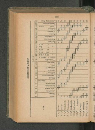
Kilometer-Zeiger
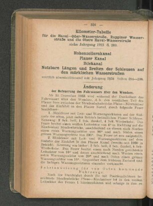
Kilometer-Tabelle
Zehntausend Kilometer
Zehntausend Kilometer
Kilometer-Tabelle
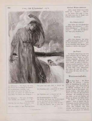
"100 Kilometer!"
Kilometer-Zeiger
3,5 Kilometer Wegebau
350 Händler auf 3,5 Kilometern
Katholische Gemeinden in Holthausen, Kreis Dortmund und Wambeln, Kreis Hamm
km 35,3-37,8; Situations-Plan. Blatt 3. Kilometer 25,1 bis Kilometer 27,65.
km 31,7-35,3; Situations-Plan. Blatt 2. Kilometer 21,5 bis Kilometer 25,1.
Kilometer-Zeiger
Kilometer-Tabelle
Zehntausend Kilometer
Zehntausend Kilometer
Kilometer-Tabelle
"100 Kilometer!"