- Reference number
-
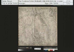
Sächsisches Staatsarchiv, 40046 Topographische und Geognostische Karten, Nr. 6-I291 (Zu benutzen im Bergarchiv Freiberg)
- Further information
-
Kartentype: Meßtischblatt, braun gedruckt
Personen/Institutionen: Blattrandbearbeitung: VD Sachsen
Maßstab: 1:25 000
Format: 65 x 53
Registratursignatur: 5247
- Context
-
40046 Topographische und Geognostische Karten >> 6. Topographische Karte der DDR - Messtischblätter 1: 25 000
- Holding
-
40046 Topographische und Geognostische Karten
- Date of creation
-
1912, 1936, 1955
- Other object pages
- Provenance
-
Nachdruck: VDS
- Rights
-
Es gilt die Sächsische Archivbenutzungsverordnung vom 8. September 2022 (SächsGVBl. S. 526).
- Last update
-
21.03.2024, 8:06 AM CET
Data provider
This object is provided by:
Sächsisches Staatsarchiv. If you have any questions about the object, please contact the data provider.
Sächsisches Staatsarchiv. If you have any questions about the object, please contact the data provider.
Object type
- Karten und Pläne
Time of origin
- 1912, 1936, 1955
Other Objects (12)

Nassau
Wilhelm von Nassau
Dittersbach, Nassau, Clausnitz, Dorfchemnitz
Dittersbach, Nassau, Clausnitz, Dorfchemnitz
Dittersbach, Nassau, Clausnitz, Dorfchemnitz
Herzog Adolf zu Nassau
Dittersbach, Nassau, Clausnitz, Dorfchemnitz
Erfassung von Bergbaugebieten - Nassau
Dittersbach, Nassau, Clausnitz, Dorfchemnitz
Bergbauflächen und Bauvorhaben - Nassau
Dittersbach, Nassau, Clausnitz, Dorfchemnitz
Bergbauflächen und Bergbauschutzgebiete - Nassau
Nassau
Wilhelm von Nassau
Dittersbach, Nassau, Clausnitz, Dorfchemnitz
Dittersbach, Nassau, Clausnitz, Dorfchemnitz
Dittersbach, Nassau, Clausnitz, Dorfchemnitz
Herzog Adolf zu Nassau
Dittersbach, Nassau, Clausnitz, Dorfchemnitz
Erfassung von Bergbaugebieten - Nassau
Dittersbach, Nassau, Clausnitz, Dorfchemnitz
Bergbauflächen und Bauvorhaben - Nassau
Dittersbach, Nassau, Clausnitz, Dorfchemnitz