Karte / Plan
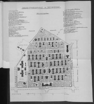
Situationsplan von der reformierten Kirche und dem neuen Rathaus in Detmold
- Reference number
-
D 73, 4/5331
- Dimensions
-
Höhe: 31, Breite: 24, Maßstab: ca. 1:483
- Context
-
Allgemeine Kartensammlung (bisherige Kartei) >> 22. Tit. 4 (noch nicht klassifiziert) >> 22.10. Nr. 5201- 5400
- Holding
-
D 73 Allgemeine Kartensammlung (bisherige Kartei)
- Date of creation
-
1832
- Other object pages
- Provenance
-
Behörden, Institutionen, Einzelpersonen (Sammlungen)
- Delivered via
- Last update
-
05.11.2025, 3:49 PM CET
Data provider
This object is provided by:
Landesarchiv Nordrhein-Westfalen. Abteilung Ostwestfalen-Lippe. If you have any questions about the object, please contact the data provider.
Landesarchiv Nordrhein-Westfalen. Abteilung Ostwestfalen-Lippe. If you have any questions about the object, please contact the data provider.
Object type
- Karten / Pläne
Time of origin
- 1832
Other Objects (12)

Situationsplan Rathaus
Detmold, reformierte Stadt- und Landgemeinde: Geistliches Kataster der reformierten Stadtgemeinde Detmold
Detmold, reformierte Stadt- und Landgemeinde: Geistliches Kataster der reformierten Landgemeinde Detmold
Detmold, reformierte Stadt- und Landgemeinde: Geistliches Kataster der reformierten Gemeinde Detmold
Situationsplan des Palaisgartens in Detmold
"Varia der reformierten Kirchengemeinde Detmold"
Detmold, reformierte Gemeinde: Totengräber Bruns
Situationsplan zum Bau eines neuen Ressource-Gebäudes in Detmold;. auf Transparent
Situationsplan der Lemgoer Straße in Detmold
Situationsplan von der Untermühle in Detmold
Situationsplan von der Badeanstalt in Detmold
Neues-Krankenhau. Situationsplan.
Situationsplan Rathaus
Detmold, reformierte Stadt- und Landgemeinde: Geistliches Kataster der reformierten Stadtgemeinde Detmold
Detmold, reformierte Stadt- und Landgemeinde: Geistliches Kataster der reformierten Landgemeinde Detmold
Detmold, reformierte Stadt- und Landgemeinde: Geistliches Kataster der reformierten Gemeinde Detmold
Situationsplan des Palaisgartens in Detmold
"Varia der reformierten Kirchengemeinde Detmold"
Detmold, reformierte Gemeinde: Totengräber Bruns
Situationsplan zum Bau eines neuen Ressource-Gebäudes in Detmold;. auf Transparent
Situationsplan der Lemgoer Straße in Detmold
Situationsplan von der Untermühle in Detmold
Situationsplan von der Badeanstalt in Detmold