- Reference number
-
Sächsisches Staatsarchiv, 40046 Topographische und Geognostische Karten, Nr. 5-H6 (Zu benutzen im Bergarchiv Freiberg)
- Further information
-
Kartentype: Meßtischblatt, Mehrfarbdruck
Maßstab: 1:100000
Format: 45 x 40
Registratursignatur: 51
- Context
-
40046 Topographische und Geognostische Karten >> 5. Topographische Karte der DDR 1: 100 000
- Holding
-
40046 Topographische und Geognostische Karten
- Date of creation
-
Stand 1983 Ausgabe 1986
- Other object pages
- Provenance
-
Hergestellt und herausgeben: Ministerium für Nationale Verteidigung, Militärtopographischer Dienst
- Rights
-
Es gilt die Sächsische Archivbenutzungsverordnung vom 8. September 2022 (SächsGVBl. S. 526).
- Last update
-
21.03.2024, 8:22 AM CET
Data provider
This object is provided by:
Sächsisches Staatsarchiv. If you have any questions about the object, please contact the data provider.
Sächsisches Staatsarchiv. If you have any questions about the object, please contact the data provider.
Object type
- Karten und Pläne
Time of origin
- Stand 1983 Ausgabe 1986
Other Objects (12)
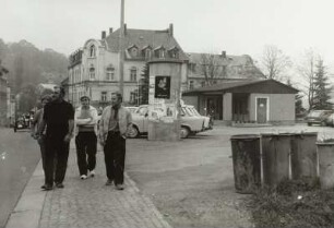
Fotografie, Annaberg-Buchholz Annaberg-Buchholz
Fotografie, Annaberg-Buchholz Annaberg-Buchholz

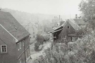
Häuserzeile, Annaberg-Buchholz Annaberg-Buchholz
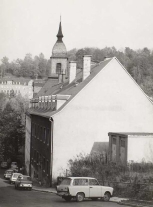
Fotografie, Annaberg-Buchholz Annaberg-Buchholz
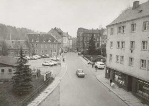
Straße, Annaberg-Buchholz Annaberg-Buchholz

Blatt M-33-51 Annaberg - Buchholz
Blatt M-33-51 Annaberg - Buchholz
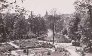
Annaberg-Buchholz, Stadtpark : Annaberg-Buchholz. Stadtpark

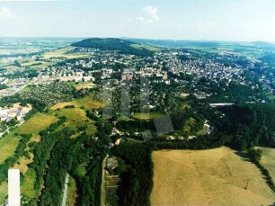
⟦Annaberg-Buchholz⟧
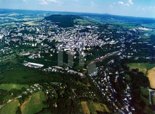
Annaberg-Buchholz
Annaberg-Buchholz
Annaberg-Buchholz
Fotografie, Annaberg-Buchholz Annaberg-Buchholz
Fotografie, Annaberg-Buchholz Annaberg-Buchholz
Häuserzeile, Annaberg-Buchholz Annaberg-Buchholz
Fotografie, Annaberg-Buchholz Annaberg-Buchholz
Straße, Annaberg-Buchholz Annaberg-Buchholz
Blatt M-33-51 Annaberg - Buchholz
Blatt M-33-51 Annaberg - Buchholz
Annaberg-Buchholz, Stadtpark : Annaberg-Buchholz. Stadtpark
⟦Annaberg-Buchholz⟧
Annaberg-Buchholz
Annaberg-Buchholz
Annaberg-Buchholz
Fotografie, Annaberg-Buchholz Annaberg-Buchholz
Fotografie, Annaberg-Buchholz Annaberg-Buchholz
Häuserzeile, Annaberg-Buchholz Annaberg-Buchholz
Fotografie, Annaberg-Buchholz Annaberg-Buchholz
Straße, Annaberg-Buchholz Annaberg-Buchholz
Blatt M-33-51 Annaberg - Buchholz
Blatt M-33-51 Annaberg - Buchholz
Annaberg-Buchholz, Stadtpark : Annaberg-Buchholz. Stadtpark
⟦Annaberg-Buchholz⟧
Annaberg-Buchholz
Annaberg-Buchholz