Karte / Plan
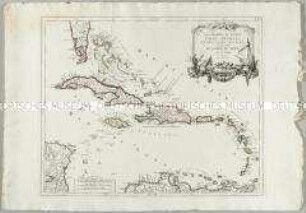
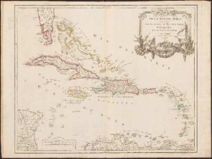
Antillen (Inselgruppe im Atlantik), topographische Karte: Partie de la Mer du Nord, où se trouvent les Grandes et Petites Isles Antilles, et les Isles Lucayes. Par le Sr. Robert Geographe ordinaire du Roy, Avec Privilege. 1750 / Guill. Delahaye sculpsit.
- Former reference number
-
Bibliothek Harff-Dreiborn, Landkarten Nr. 229
- Dimensions
-
Höhe: 48 cm, Breite: 59 cm
- Context
-
RW Karten >> 1. Topographische Karten >> 1.3. Landesaufnahme Ausland >> 1.3.2. Amerika
- Holding
-
RW Karten
- Date of creation
-
1750
- Other object pages
- Provenance
-
Diverse Registraturbildner
- Delivered via
- Last update
-
05.11.2025, 4:13 PM CET
Data provider
This object is provided by:
Landesarchiv Nordrhein-Westfalen. Abteilung Rheinland. If you have any questions about the object, please contact the data provider.
Landesarchiv Nordrhein-Westfalen. Abteilung Rheinland. If you have any questions about the object, please contact the data provider.
Object type
- Karten / Pläne
Time of origin
- 1750
Other Objects (12)
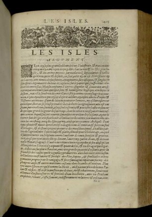
Les Isles

Les Isles
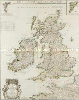
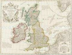
Les Isles Britanniques. Mit zwei Nebenkarten: Les isles de ferro; Les isles de Schetland
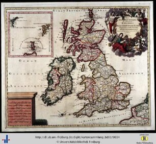
Les isles Britanniques
Les Isles Britanniques
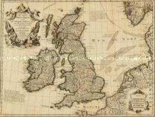
Les Isles Britanniques
Les Grandes et Petites Isles Antilles et les Isles Lucayes
![DETROIT DE LA SONDE.; LES ISLES DU PASSAGE [...].](https://iiif.deutsche-digitale-bibliothek.de/image/2/a44890e0-4c30-43c8-9300-895e061b1ce7/full/!306,450/0/default.jpg)
DETROIT DE LA SONDE.; LES ISLES DU PASSAGE [...].
Les Isles Antilles, Et Le Golfe Du Méxique
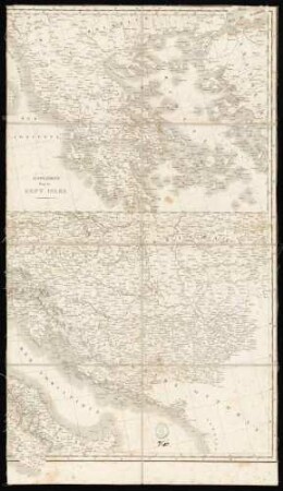
Supplément pour les Sept Isles
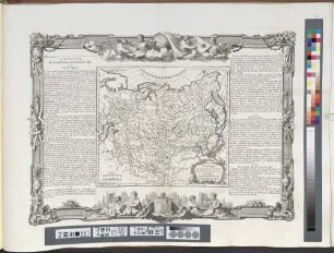
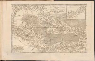
Grande Tartarie Et Isles Du Japon : Suivant les Rélations les plus autentiques
Partie De La Mer Du Nord, où se trouvent Les Grandes Et Petites Isles Antilles, Et Les Isles Lucayes : Avec Privilege
Les Isles
Les Isles
Les Isles Britanniques. Mit zwei Nebenkarten: Les isles de ferro; Les isles de Schetland
Les isles Britanniques
Les Isles Britanniques
Les Isles Britanniques
Les Grandes et Petites Isles Antilles et les Isles Lucayes
DETROIT DE LA SONDE.; LES ISLES DU PASSAGE [...].
Les Isles Antilles, Et Le Golfe Du Méxique
Supplément pour les Sept Isles
Grande Tartarie Et Isles Du Japon : Suivant les Rélations les plus autentiques