Karte / Plan
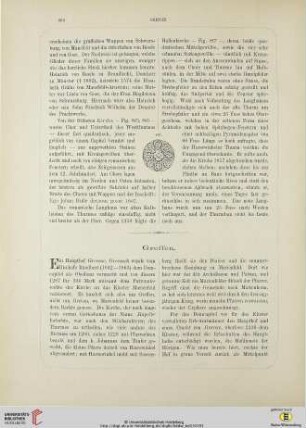
Situationsplan zum Bau der Strasse von Sassenberg über Greffen, Harsewinkel und Marienfeld nach der Gütersloher Gemeindegrenze. In 5 Sectionen. 3te Section, Gemeinde GREFFEN.
- Reference number
-
S 07 Kartensammlung, 765
- Dimensions
-
208x56 cm
- Formal description
-
Tuschezeichnung
- Material
-
Papier auf Leinen
- Notes
-
Plan zusammenklappbar aus sechs Teilen. Vorderseite historisch etikettiert: "Situationsplan Section 3, Greffen."; coloriert
- Further information
-
Ort: Greffen
Maßstab: 1:2500
- Context
-
Kartensammlung >> Karten und Pläne >> Verkehrspläne (Eisenbahn, Straßen und Wege, Kabel) >> Straßen
- Holding
-
S 07 Kartensammlung Kartensammlung
- Date of creation
-
[1873]
- Other object pages
- Delivered via
- Last update
-
05.11.2025, 3:36 PM CET
Data provider
This object is provided by:
Kreis Warendorf. Kreisarchiv, Kreisverwaltung. If you have any questions about the object, please contact the data provider.
Kreis Warendorf. Kreisarchiv, Kreisverwaltung. If you have any questions about the object, please contact the data provider.
Object type
- Karten und Pläne
Time of origin
- [1873]
Other Objects (12)

Strassenbau von Sassenberg nach der Gütersloher Gemeindegrenze. Längenprofil. 3te Section, Gemeinde Greffen = 1835 Meter.
Wegekreuz Sassenberg - Greffen
Wegekreuz Sassenberg - Greffen
Wegekreuz Sassenberg - Greffen
Bildstock Sassenberg - Greffen
Deutsche Grundkarte 5, Greffen-West (Sassenberg/Greffen)
Situationsplan zum Bau der Strasse von Sassenberg über Greffen, Harsewinkel, und Marienfeld nach der Gütersloher Gemeindegrenze. In 5 Sectionen. 1ste Section, Gemeinde SASSENBERG.
Sassenberg-Greffen-Harsewinkel-Marienfeld
Umpfarrung nach Sassenberg und Greffen
Situationsplan zum Bau der Strasse von Sassenberg über Greffen, Harsewinkel und Marienfeld nach der Gütersloher Gemeindegrenze. In 5 Sectionen. 2te Section Gemeinde DACKMAR.
Situationsplan zum Bau der Strasse von Sassenberg über Greffen, Harsewinkel und Marienfeld nach der Gütersloher Gemeindegrenze. In 5 Sectionen. 4te Section, Gemeinde HARSEWINKEL.
⟦Greffen⟧
Strassenbau von Sassenberg nach der Gütersloher Gemeindegrenze. Längenprofil. 3te Section, Gemeinde Greffen = 1835 Meter.
Wegekreuz Sassenberg - Greffen
Wegekreuz Sassenberg - Greffen
Wegekreuz Sassenberg - Greffen
Bildstock Sassenberg - Greffen
Deutsche Grundkarte 5, Greffen-West (Sassenberg/Greffen)
Situationsplan zum Bau der Strasse von Sassenberg über Greffen, Harsewinkel, und Marienfeld nach der Gütersloher Gemeindegrenze. In 5 Sectionen. 1ste Section, Gemeinde SASSENBERG.
Sassenberg-Greffen-Harsewinkel-Marienfeld
Umpfarrung nach Sassenberg und Greffen
Situationsplan zum Bau der Strasse von Sassenberg über Greffen, Harsewinkel und Marienfeld nach der Gütersloher Gemeindegrenze. In 5 Sectionen. 2te Section Gemeinde DACKMAR.
Situationsplan zum Bau der Strasse von Sassenberg über Greffen, Harsewinkel und Marienfeld nach der Gütersloher Gemeindegrenze. In 5 Sectionen. 4te Section, Gemeinde HARSEWINKEL.