Karte / Plan
Schnitte und Risse eines Wohnhauses für das Gelände der Infanterie-Kaserne in Detmold
- Reference number
-
D 73, 4/18663
- Extent
-
2 Bl.
- Dimensions
-
Höhe: 61,2, Breite: 73,5, Maßstab: 1:100
- Notes
-
Blatt 2
- Further information
-
Ort: Detmold
- Context
-
Allgemeine Kartensammlung (VERA-Verzeichnung) >> 1. Allgemeine Sammlung >> 1.1. Bausachen (Hochbau, Tiefbau, Lagepläne) >> 1.1.1. Ortsbebauung >> 1.1.1.4. Orte D >> 1.1.1.4.2. Detmold >> 1.1.1.4.2.5. Detmold
- Holding
-
D 73 Allgemeine Kartensammlung (VERA-Verzeichnung)
- Indexentry place
-
Detmold
- Date of creation
-
1926-1927
- Other object pages
- Provenance
-
Behörden, Institutionen, Einzelpersonen (Sammlungen)
- Delivered via
- Last update
-
05.11.2025, 4:30 PM CET
Data provider
This object is provided by:
Landesarchiv Nordrhein-Westfalen. Abteilung Ostwestfalen-Lippe. If you have any questions about the object, please contact the data provider.
Landesarchiv Nordrhein-Westfalen. Abteilung Ostwestfalen-Lippe. If you have any questions about the object, please contact the data provider.
Object type
- Karten / Pläne
Time of origin
- 1926-1927
Other Objects (12)

Schnitte und Risse eines Wohnhauses für das Gelände der Infanterie-Kaserne in Detmold
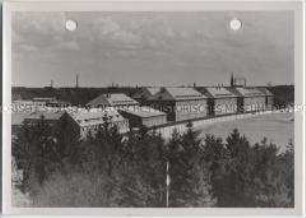
Infanterie-Kaserne
Infanterie-Kaserne
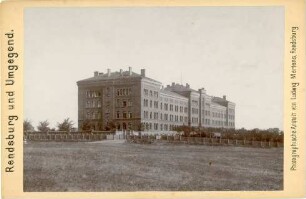
Neumünster, Infanterie-Kaserne
Infanterie-Kaserne (Uhrenblock)
Darmstadt, Infanterie-Kaserne / Soldaten, gruppiert vor Fassade der Infanterie-Kaserne
Infanterie-Kaserne, Bund II
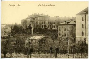
Leisnig. Alte Infanterie-Kaserne
Infanterie-Kaserne Merseburg (Lageplan)
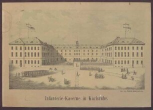
Infanterie-Kaserne in Karlsruhe
Infanterie-Kaserne, Bund I
Infanterie-Kaserne, Deutsches Haus
Schnitte und Risse eines Wohnhauses für das Gelände der Infanterie-Kaserne in Detmold
Infanterie-Kaserne
Infanterie-Kaserne
Neumünster, Infanterie-Kaserne
Infanterie-Kaserne (Uhrenblock)
Darmstadt, Infanterie-Kaserne / Soldaten, gruppiert vor Fassade der Infanterie-Kaserne
Infanterie-Kaserne, Bund II
Leisnig. Alte Infanterie-Kaserne
Infanterie-Kaserne Merseburg (Lageplan)
Infanterie-Kaserne in Karlsruhe
Infanterie-Kaserne, Bund I