Karten und Pläne
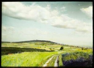
Grund-Riß über den Lauff des Neccars vom Kiebinger Steg an biß an den Spitz-Berg
- Reference number
-
D 30/K 3242
- Former reference number
-
prefix: D 30/K
- Dimensions
-
20 x 30 cm
- Formal description
-
Hirschauer Steg bis Spitzberg
- Material
-
Fotopapier
- Notes
-
Reproduktion - Original im Hauptstaatsarchiv Stuttgart Signatur B 33 Bü 61
- Further information
-
Ausführung: Fotografische Reproduktion (2 Dias und 2 Fotoabzüge)
- Context
-
D 30 Karten- und Plansammlung >> Wasserbauwesen an Neckar, Ammer und Steinlach
- Holding
-
D 30 Karten- und Plansammlung
- Indexbegriff subject
-
Neckarlauf 1775
Neckarstromkarte
- Indexentry place
-
Hirschau, Neckarlauf 1775
- Date of creation
-
1775
- Other object pages
- Last update
-
29.04.2025, 8:35 AM CEST
Data provider
This object is provided by:
Stadtarchiv Tübingen. If you have any questions about the object, please contact the data provider.
Stadtarchiv Tübingen. If you have any questions about the object, please contact the data provider.
Object type
- Karte und Plan
Time of origin
- 1775
Other Objects (12)

Spitzberg, Wald-Café Spitzberg
Spitzberg, Wald-Café Spitzberg
Spitzberg, Wald-Café Spitzberg
Spitzberg, Wald-Café Spitzberg
Spitzberg
Spitzberg

Spitzberg.
Spitzberg
Cottaer Spitzberg : Blick zum Cottaer Spitzberg
Nachlaßakte Paul Spitzberg und Marie Spitzberg
Feldbereinigung Spitzberg
Naturschutzgebiet Spitzberg
Spitzberg, Wald-Café Spitzberg
Spitzberg, Wald-Café Spitzberg
Spitzberg, Wald-Café Spitzberg
Spitzberg, Wald-Café Spitzberg
Spitzberg
Spitzberg
Spitzberg.
Spitzberg
Cottaer Spitzberg : Blick zum Cottaer Spitzberg
Nachlaßakte Paul Spitzberg und Marie Spitzberg
Feldbereinigung Spitzberg