Karte / Plan
Karte von Frankreich 1:80.000. Gruppe II: Château-Chinon 124 C. [Kartographische Abtheilung der Königl. Preuss. Landes-Aufnahme]
- Reference number
-
RW Karten, 7011
- Dimensions
-
Maßstab: 1:80.000
- Context
-
RW Karten >> 1. Topographische Karten >> 1.3. Landesaufnahme Ausland >> 1.3.3. Europa >> 1.3.3.3. Frankreich
- Holding
-
RW Karten
- Date of creation
-
1915/1916
- Other object pages
- Provenance
-
Diverse Registraturbildner
- Delivered via
- Last update
-
17.09.2025, 3:22 PM CEST
Data provider
This object is provided by:
Landesarchiv Nordrhein-Westfalen. Abteilung Rheinland. If you have any questions about the object, please contact the data provider.
Landesarchiv Nordrhein-Westfalen. Abteilung Rheinland. If you have any questions about the object, please contact the data provider.
Object type
- Karten / Pläne
Time of origin
- 1915/1916
Other Objects (12)
![Karte von Frankreich 1:80.000. Gruppe II: Château-Chinon 124 D. [Kartographische Abtheilung der Königl. Preuss. Landes-Aufnahme]](https://iiif.deutsche-digitale-bibliothek.de/image/2/c8793b53-e6e6-43a1-9286-6523d23a4103/full/!306,450/0/default.jpg)
Karte von Frankreich 1:80.000. Gruppe II: Château-Chinon 124 D. [Kartographische Abtheilung der Königl. Preuss. Landes-Aufnahme]
![Karte von Frankreich 1:80.000. Gruppe II: Château-Chinon 124 A. [Kartographische Abtheilung der Königl. Preuss. Landes-Aufnahme]](https://iiif.deutsche-digitale-bibliothek.de/image/2/b15f4dc7-7438-4dc4-b12a-8d8146c867b6/full/!306,450/0/default.jpg)
Karte von Frankreich 1:80.000. Gruppe II: Château-Chinon 124 A. [Kartographische Abtheilung der Königl. Preuss. Landes-Aufnahme]
![Karte von Frankreich 1:80.000. Gruppe II: Château-Chinon 124 B. [Kartographische Abtheilung der Königl. Preuss. Landes-Aufnahme]](https://iiif.deutsche-digitale-bibliothek.de/image/2/f7edb3ec-69ae-455d-abaf-9dae6e01c2dd/full/!306,450/0/default.jpg)
Karte von Frankreich 1:80.000. Gruppe II: Château-Chinon 124 B. [Kartographische Abtheilung der Königl. Preuss. Landes-Aufnahme]
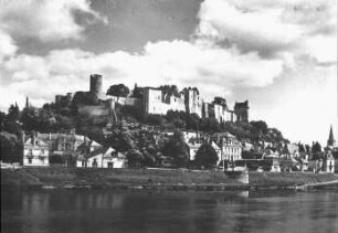
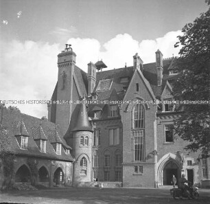
Chinon, Schloss (Château de Chinon)
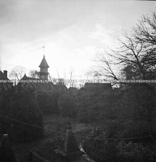
Gebäude in Chateau Chinon

Umgebungskarte (1:80.000)
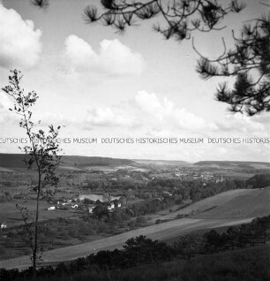
Landschaft bei Chateau Chinon (?) (Frankreichfeldzug)
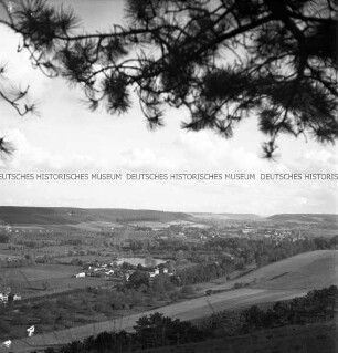
Landschaft bei Chateau Chinon (?) (Frankreichfeldzug)
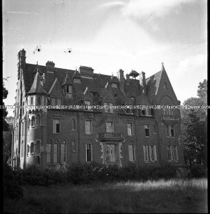
Gebäude in Chateau Chinon (?) (Frankreichfeldzug)
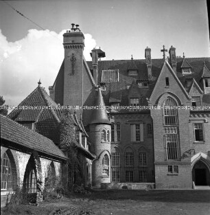
Gebäude in Chateau Chinon (?) (Frankreichfeldzug)
Gebäude in Chateau Chinon (?) (Frankreichfeldzug)
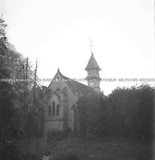
Kirche (?) in Chateau Chinon (Frankreichfeldzug)
Karte von Frankreich 1:80.000. Gruppe II: Château-Chinon 124 D. [Kartographische Abtheilung der Königl. Preuss. Landes-Aufnahme]
Karte von Frankreich 1:80.000. Gruppe II: Château-Chinon 124 A. [Kartographische Abtheilung der Königl. Preuss. Landes-Aufnahme]
Karte von Frankreich 1:80.000. Gruppe II: Château-Chinon 124 B. [Kartographische Abtheilung der Königl. Preuss. Landes-Aufnahme]
Chinon, Schloss (Château de Chinon)
Gebäude in Chateau Chinon
Umgebungskarte (1:80.000)
Landschaft bei Chateau Chinon (?) (Frankreichfeldzug)
Landschaft bei Chateau Chinon (?) (Frankreichfeldzug)
Gebäude in Chateau Chinon (?) (Frankreichfeldzug)
Gebäude in Chateau Chinon (?) (Frankreichfeldzug)
Gebäude in Chateau Chinon (?) (Frankreichfeldzug)