Karte / Plan
Plan von der Lage des Forstanschlusswegs im Bärental bei Kohlstädt (Amt Horn)
- Reference number
-
D 73, 4/6004
- Dimensions
-
Höhe: 43, Breite: 66, Maßstab: 1:500
- Context
-
Allgemeine Kartensammlung (bisherige Kartei) >> 22. Tit. 4 (noch nicht klassifiziert) >> 22.15. Nr. 6001 - 6200
- Holding
-
D 73 Allgemeine Kartensammlung (bisherige Kartei)
- Date of creation
-
1875
- Other object pages
- Provenance
-
Behörden, Institutionen, Einzelpersonen (Sammlungen)
- Delivered via
- Last update
-
05.11.2025, 3:53 PM CET
Data provider
This object is provided by:
Landesarchiv Nordrhein-Westfalen. Abteilung Ostwestfalen-Lippe. If you have any questions about the object, please contact the data provider.
Landesarchiv Nordrhein-Westfalen. Abteilung Ostwestfalen-Lippe. If you have any questions about the object, please contact the data provider.
Object type
- Karten / Pläne
Time of origin
- 1875
Other Objects (12)

Lageplan des Forstanschlussweges im Bärental bei Kohlstädt (Amt Horn)
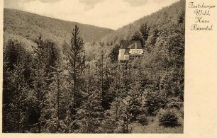
Teutoburger Wald, Haus Bärental, bei Kohlstädt Postkarte E. Paap, Wald-Hotel und Sommerfrische, Bärental im Teutoburger Wald b. Kohlstädt i. Lippe
Kohlstädt, Bärental, Gauß-Krüger-Koordinaten: Rechtswert: 3492, Hochwert: 5744

Kohlstädt, Bärental, Gauß-Krüger-Koordinaten: Rechtswert: 3492, Hochwert: 5744

Kohlstädt, Bärental, Gauß-Krüger-Koordinaten: Rechtswert: 3492, Hochwert: 5744
2.114. Gemarkung Kohlstädt-Horn
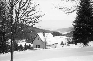
Bärental: Haus im Bärental
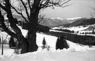
Bärental: Bärental mit Feldberg
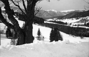
Bärental: Bärental mit Feldberg
Vererbpachtung eines Platzes im Bärental an den Kolon Möllenberend Nr. 2 in Kohlstädt
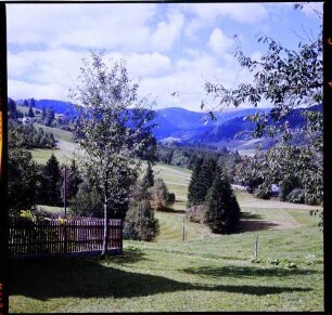
Feldberg, Bärental: Bärental mit Feldberg
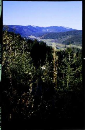
Feldberg, Bärental: Blick ins Bärental
Lageplan des Forstanschlussweges im Bärental bei Kohlstädt (Amt Horn)
Teutoburger Wald, Haus Bärental, bei Kohlstädt Postkarte E. Paap, Wald-Hotel und Sommerfrische, Bärental im Teutoburger Wald b. Kohlstädt i. Lippe
Kohlstädt, Bärental, Gauß-Krüger-Koordinaten: Rechtswert: 3492, Hochwert: 5744
Kohlstädt, Bärental, Gauß-Krüger-Koordinaten: Rechtswert: 3492, Hochwert: 5744
Kohlstädt, Bärental, Gauß-Krüger-Koordinaten: Rechtswert: 3492, Hochwert: 5744
2.114. Gemarkung Kohlstädt-Horn
Bärental: Haus im Bärental
Bärental: Bärental mit Feldberg
Bärental: Bärental mit Feldberg
Vererbpachtung eines Platzes im Bärental an den Kolon Möllenberend Nr. 2 in Kohlstädt
Feldberg, Bärental: Bärental mit Feldberg