Karte / Plan
Bestimmung des Hochwasserfreigebiets der Ruhr. Querprofile km 53,8 - 53,9; 64,8; 65,2. 3 Bl.
- Reference number
-
RW Karten, 4896 - c
- Dimensions
-
Höhe: 76 cm, Breite: 58 cm, Maßstab: 1 : 1250 (L), 1 : 100 (H)
- Context
-
RW Karten >> 5. Gewässer >> 5.3. Ruhr >> 5.3.3. Hochwasserfreigebiete
- Holding
-
RW Karten
- Date of creation
-
[um 1890]
- Other object pages
- Provenance
-
Diverse Registraturbildner
- Delivered via
- Last update
-
05.11.2025, 3:39 PM CET
Data provider
This object is provided by:
Landesarchiv Nordrhein-Westfalen. Abteilung Rheinland. If you have any questions about the object, please contact the data provider.
Landesarchiv Nordrhein-Westfalen. Abteilung Rheinland. If you have any questions about the object, please contact the data provider.
Object type
- Karten / Pläne
Time of origin
- [um 1890]
Other Objects (12)

Bestimmung des Hochwasserfreigebiets der Ruhr. Querprofile km 53,8 - 53,9; 64,8; 65,2. 3 Bl.

Bestimmung des Hochwasserfreigebiets der Ruhr. Querprofile km 53,8 - 53,9; 64,8; 65,2. 3 Bl.

Marienberghausen Fl. 53/9
Marienberghausen Fl. 53/8
Geilenkirchen Fl. 53/8
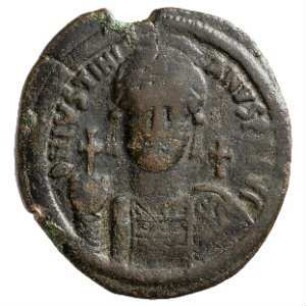
Münze, Follis, 538 / 539

538-539 Alte Bibelübersetzungen
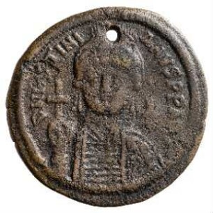
Münze, Follis, 538 / 539
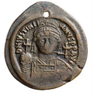
Münze, Follis, 538 / 539
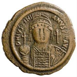
Münze, Follis, 538 / 539

Münze, Follis, 538 / 539
Hohenzollernkanal Km 53,9. Lageplan
Bestimmung des Hochwasserfreigebiets der Ruhr. Querprofile km 53,8 - 53,9; 64,8; 65,2. 3 Bl.
Bestimmung des Hochwasserfreigebiets der Ruhr. Querprofile km 53,8 - 53,9; 64,8; 65,2. 3 Bl.
Marienberghausen Fl. 53/9
Marienberghausen Fl. 53/8
Geilenkirchen Fl. 53/8
Münze, Follis, 538 / 539
538-539 Alte Bibelübersetzungen
Münze, Follis, 538 / 539
Münze, Follis, 538 / 539
Münze, Follis, 538 / 539
Münze, Follis, 538 / 539