Karte / Plan
Nr. 2541 9, Kreis Düren, Gemeinde Jülich, Gemarkung Jülich. Titelzusatz: Flur 5. Blattinhalt: a. -; b. Christinastraße; Freiherr-vom-Stein-Platz; Rochusstraße; Barbarastraße; Lorsbecker Straße; c. -; d. -
Begleittext: Kreis Düren. Der Oberkreisdirektor – Verwaltungsstelle Jülich – 02. Okt 1979.
- Reference number
-
C - Jülich, C - 54
- Dimensions
-
Blatt: 1045 × 620 mm
- Notes
-
Klebestreifen für Hängeregistratur an der linken Seite.
- Further information
-
Ort: o. A.
Maßstab: 1 : 1000
- Context
-
Jülich
- Holding
-
C - Jülich Jülich
- Date of creation
-
1979
- Other object pages
- Provenance
-
unbekannt
- Delivered via
- Last update
-
17.09.2025, 2:38 PM CEST
Data provider
This object is provided by:
Stadtarchiv Jülich. If you have any questions about the object, please contact the data provider.
Stadtarchiv Jülich. If you have any questions about the object, please contact the data provider.
Object type
- Karten und Pläne
Time of origin
- 1979
Other Objects (12)

Jülich. Broicher Haus – Freiwald; Neubourheim/Rochusstraße - Königskamp
Progymnasium Jülich. Titelzusatz: -. Blattinhalt: 1 Längenschnitt
[Ehemalige Jesuitenkirche in Jülich ?]. Titelzusatz: –. Blattinhalt:
[Ehemalige Jesuitenkirche in Jülich]. Titelzusatz: –. Blattinhalt: Außenansicht
Progymnasium Jülich. [Fensterbogensteine]. Titelzusatz: -. Blattinhalt: 1 Teilansicht
Progymnasium Jülich. [Fensterbogensteine]. Titelzusatz: -. Blattinhalt: 2 Teilansichten
[Gymnasium Jülich.]. Titelzusatz: -. Blattinhalt: 1 Grundriss (Erdgeschoss)
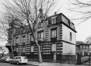
Hanau, Rochusstraße 31B, Rochusstraße 31C
[Gymnasium Jülich.]. Titelzusatz: Jülich, im August 1930. Stadtbaumeister. Blattinhalt: 1 Grundriss (Kellergeschoss)
Schlachthof Jülich. Titelzusatz: Jülich, de 12.10.1957, [Paraphe]. Blattinhalt: 1 Grundriss (Grossviehschlachthalle; Caldaune)
Rochusstraße
Rochusstraße
Jülich. Broicher Haus – Freiwald; Neubourheim/Rochusstraße - Königskamp
Progymnasium Jülich. Titelzusatz: -. Blattinhalt: 1 Längenschnitt
[Ehemalige Jesuitenkirche in Jülich ?]. Titelzusatz: –. Blattinhalt:
[Ehemalige Jesuitenkirche in Jülich]. Titelzusatz: –. Blattinhalt: Außenansicht
Progymnasium Jülich. [Fensterbogensteine]. Titelzusatz: -. Blattinhalt: 1 Teilansicht
Progymnasium Jülich. [Fensterbogensteine]. Titelzusatz: -. Blattinhalt: 2 Teilansichten
[Gymnasium Jülich.]. Titelzusatz: -. Blattinhalt: 1 Grundriss (Erdgeschoss)
Hanau, Rochusstraße 31B, Rochusstraße 31C
[Gymnasium Jülich.]. Titelzusatz: Jülich, im August 1930. Stadtbaumeister. Blattinhalt: 1 Grundriss (Kellergeschoss)
Schlachthof Jülich. Titelzusatz: Jülich, de 12.10.1957, [Paraphe]. Blattinhalt: 1 Grundriss (Grossviehschlachthalle; Caldaune)
Rochusstraße