Karte / Plan
Brilon (Kreis) amtliche Entfernungskarte (1944) 1969 1 : 50 000 82 x 59 Druck Regierung Arnsberg
- Former reference number
-
Regierung Arnsberg
- Further information
-
Ort: Kreis Brilon
- Context
-
Karten A (Allgemein) >> 4. Verwaltung >> 4.4. Entfernungskarten
- Holding
-
W 051 Karten A (Allgemein)
- Indexentry place
-
Kreis Brilon
Brilon, Kreis, Entfernungskarte, 1969
- Date of creation
-
1969
- Other object pages
- Provenance
-
Sammlungsregistraturbildner
- Delivered via
- Last update
-
17.09.2025, 3:24 PM CEST
Data provider
This object is provided by:
Landesarchiv Nordrhein-Westfalen. Abteilung Westfalen. If you have any questions about the object, please contact the data provider.
Landesarchiv Nordrhein-Westfalen. Abteilung Westfalen. If you have any questions about the object, please contact the data provider.
Object type
- Karten / Pläne
Time of origin
- 1969
Other Objects (12)

Lippstadt (Kreis) amtliche Entfernungskarte (1944) 1968 1 : 50 000 82 x 59 Pause Regierung Arnsberg

Lüdenscheid (Kreis) amtliche Entfernungskarte (1949) 1968 ca 1 : 50 000 59 x 82,5 Pause Regierung Arnsberg

Entfernungskarte für Gross-Berlin 1 : 2 000 000.

Hamm (Stadt- und Landkreis) amtliche Entfernungskarte 1921 1 : 75 000 47 x 59 Druck Regierung Arnsberg
Amtliche Entfernungskarte
Deutschland, Entfernungskarte.
Amtliche Entfernungskarte

Ennepe-Ruhr-Kreis amtliche Entfernungskarte (1947) 1969 1 : 43 000 59,5 x 84 Pause Regierung Arnsberg
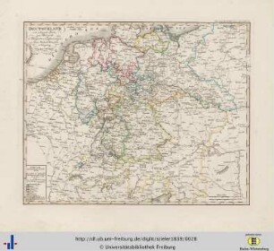
Herstellung einer Entfernungskarte von Württemberg (im Maßstab 1:200 000)

Brilon (Brilon), Flurbereinigung Brilon, Schätzungsriß Brilon Flur 59
Dortmund, Amtliche Entfernungskarte
Entfernungskarte Kreis Sieg
Lippstadt (Kreis) amtliche Entfernungskarte (1944) 1968 1 : 50 000 82 x 59 Pause Regierung Arnsberg
Lüdenscheid (Kreis) amtliche Entfernungskarte (1949) 1968 ca 1 : 50 000 59 x 82,5 Pause Regierung Arnsberg
Entfernungskarte für Gross-Berlin 1 : 2 000 000.
Hamm (Stadt- und Landkreis) amtliche Entfernungskarte 1921 1 : 75 000 47 x 59 Druck Regierung Arnsberg
Amtliche Entfernungskarte
Deutschland, Entfernungskarte.
Amtliche Entfernungskarte
Ennepe-Ruhr-Kreis amtliche Entfernungskarte (1947) 1969 1 : 43 000 59,5 x 84 Pause Regierung Arnsberg
Herstellung einer Entfernungskarte von Württemberg (im Maßstab 1:200 000)
Brilon (Brilon), Flurbereinigung Brilon, Schätzungsriß Brilon Flur 59
Dortmund, Amtliche Entfernungskarte