- Former reference number
-
III - 4, später: 94
- Dimensions
-
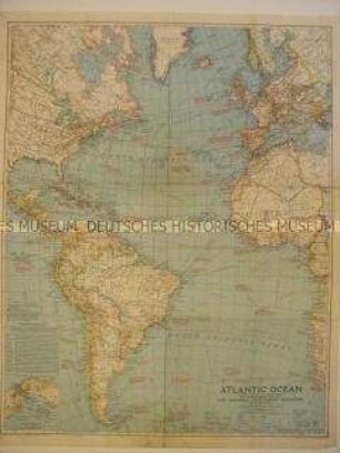
Höhe: 147 cm, Breite: 222 cm, Maßstab: 1 : 12 000 000
- Context
-
Allgemeine Kartensammlung (Schulwandkarten) >> 3. Wirtschafts- und Sozialkunde
- Holding
-
D 73 Allgemeine Kartensammlung (Schulwandkarten)
- Date of creation
-
ca. 1960
- Other object pages
- Provenance
-
Behörden, Institutionen, Einzelpersonen (Sammlungen)
- Delivered via
- Last update
-
05.11.2025, 3:23 PM CET
Data provider
This object is provided by:
Landesarchiv Nordrhein-Westfalen. Abteilung Ostwestfalen-Lippe. If you have any questions about the object, please contact the data provider.
Landesarchiv Nordrhein-Westfalen. Abteilung Ostwestfalen-Lippe. If you have any questions about the object, please contact the data provider.
Object type
- Karten / Pläne
Time of origin
- ca. 1960
Other Objects (12)

Karte: Die Wirtschaft der Erde (II), Pazifischer Wirtschaftsbereich
Jahresabschluss 1978 Wirtschaftsbereich
Organisationsprüfung im Wirtschaftsbereich
Aus dem lokalen Wirtschaftsbereich
Sachverständige im Wirtschaftsbereich Handwerk
Aus dem lokalen Wirtschaftsbereich
Aus dem lokalen Wirtschaftsbereich

Karten vom atlantischen Ocean vor Kolumbus
Karte des Atlantischen Ozeans mit Südamerika

Karte 14. Gesamtverbreitung der Atlantischen Gruppe
Bergrechtliche Fragen im Wirtschaftsbereich Steine und Erden. - Entwurf eines Bundesberggesetzes: Bd. 1
Bergrechtliche Fragen im Wirtschaftsbereich Steine und Erden. - Entwurf eines Bundesberggesetzes: Bd. 2
Karte: Die Wirtschaft der Erde (II), Pazifischer Wirtschaftsbereich
Jahresabschluss 1978 Wirtschaftsbereich
Organisationsprüfung im Wirtschaftsbereich
Aus dem lokalen Wirtschaftsbereich
Sachverständige im Wirtschaftsbereich Handwerk
Aus dem lokalen Wirtschaftsbereich
Aus dem lokalen Wirtschaftsbereich
Karten vom atlantischen Ocean vor Kolumbus
Karte des Atlantischen Ozeans mit Südamerika
Karte 14. Gesamtverbreitung der Atlantischen Gruppe
Bergrechtliche Fragen im Wirtschaftsbereich Steine und Erden. - Entwurf eines Bundesberggesetzes: Bd. 1