Verzeichnung
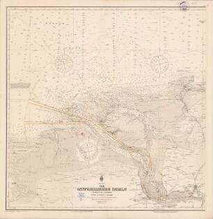
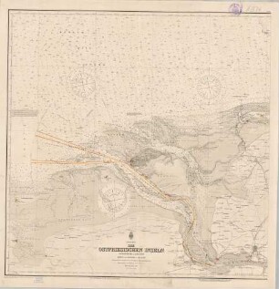
Topographische Karte von der Nordsee, den Ostfriesischen Inseln und dem nördlichen Teil Ostfrieslands Druck von E. Dorndorf Papier Format 54,5x40,0 M 1:158.000
- Reference number
-
NLA HA, Rep. 244, B Nr. 2187
- Former reference number
-
Rep. 244, 1558 A
Rep. 244 A 1558
- Context
-
Kartensammlung >> 5 Regierungsbezirk Weser-Ems >> 19 Kreisübergreifende Gebiete >> 10 Gewässer, Kanäle, Seekarten
- Holding
-
Rep. 244 Kartensammlung
- Indexbegriff subject
-
Inseln, Ostfriesische-, topographische Karte
- Indexentry person
-
Dorndorf, E.
- Indexentry place
-
Nordsee, topographische Karte
Ostfriesische Inseln, topographische Karte
Ostfriesland, topographische Karte
- Date of creation
-
- 1820
- Other object pages
- Last update
-
16.06.2025, 1:30 PM CEST
Data provider
This object is provided by:
Niedersächsisches Landesarchiv. If you have any questions about the object, please contact the data provider.
Niedersächsisches Landesarchiv. If you have any questions about the object, please contact the data provider.
Object type
- Verzeichnung
Time of origin
- - 1820
Other Objects (12)

64 Nordsee; die Ostfriesischen Inseln
64 Nordsee; die Ostfriesischen Inseln
83a Nordsee; die Ostfriesischen Inseln
64 Nordsee; die Ostfriesischen Inseln
87 Nordsee; Ostfriesischen Inseln mit Helgoland

Nordsee-Trilogie : Ostfriesland, Inselkrimis
Ostfriesland, Serie 1.. Die ostfriesischen Städte
87 Nordsee; die Ostfriesischen Inseln mit Helgoland
Sep. Dorndorf Dorndorf
Inselgutachten Nordsee der sieben ostfriesischen Inseln: Bd. 1
Inselgutachten Nordsee der sieben ostfriesischen Inseln: Bd. 2
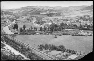
Dorndorf. Blick auf Dorndorf
64 Nordsee; die Ostfriesischen Inseln
64 Nordsee; die Ostfriesischen Inseln
83a Nordsee; die Ostfriesischen Inseln
64 Nordsee; die Ostfriesischen Inseln
87 Nordsee; Ostfriesischen Inseln mit Helgoland
Nordsee-Trilogie : Ostfriesland, Inselkrimis
Ostfriesland, Serie 1.. Die ostfriesischen Städte
87 Nordsee; die Ostfriesischen Inseln mit Helgoland
Sep. Dorndorf Dorndorf
Inselgutachten Nordsee der sieben ostfriesischen Inseln: Bd. 1
Inselgutachten Nordsee der sieben ostfriesischen Inseln: Bd. 2