- Former reference number
-
I - 15, später: 15
- Dimensions
-
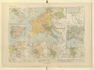
Höhe: 135 cm, Breite: 212 cm, Maßstab: 1 : 750 000
- Context
-
Allgemeine Kartensammlung (Schulwandkarten) >> 1. Geschichte >> 1.1. Karten
- Holding
-
D 73 Allgemeine Kartensammlung (Schulwandkarten)
- Date of creation
-
1953
- Other object pages
- Provenance
-
Behörden, Institutionen, Einzelpersonen (Sammlungen)
- Delivered via
- Last update
-
05.11.2025, 3:13 PM CET
Data provider
This object is provided by:
Landesarchiv Nordrhein-Westfalen. Abteilung Ostwestfalen-Lippe. If you have any questions about the object, please contact the data provider.
Landesarchiv Nordrhein-Westfalen. Abteilung Ostwestfalen-Lippe. If you have any questions about the object, please contact the data provider.
Object type
- Karten / Pläne
Time of origin
- 1953
Other Objects (12)

Karte: Deutschland 1789 und Europa bis 1815
Deutschland und Europa 1789-1815
Deutschland und Europa 1789-1815
Deutschland 1789 bis 1815
Karte: Europa 1815-1871
Martin Göhring: Frankreich und Europa von 1789-1815 (Vorlesung)
Europe (1789-1815)
1789 - 1815 (Bestand)
1789 bis 1815
1789 - 1815 (Bestand)
Deutsche Geschichte 1789-1815
Ecrits autobiographiques 1789-1815
Karte: Deutschland 1789 und Europa bis 1815
Deutschland und Europa 1789-1815
Deutschland und Europa 1789-1815
Deutschland 1789 bis 1815
Karte: Europa 1815-1871
Martin Göhring: Frankreich und Europa von 1789-1815 (Vorlesung)
Europe (1789-1815)
1789 - 1815 (Bestand)
1789 bis 1815
1789 - 1815 (Bestand)
Deutsche Geschichte 1789-1815