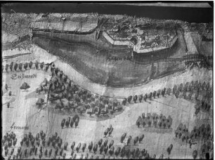
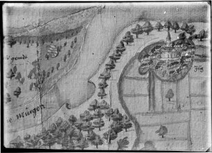
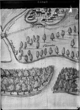
Karte / Plan
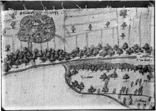
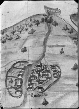
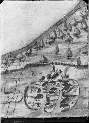
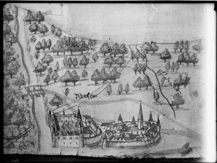
Plan von der Lage des Rheins am Niehler Hamm [Rheinlauf von oberhalb Stammheim bis Wiesdorf. Mit Uferbauten und Grinden]. I 7/13
- Reference number
-
RW Karten, 2310
- Dimensions
-
Höhe: 136 cm, Breite: 67 cm, Maßstab: [ca. 1 : 4700]
- Context
-
RW Karten >> 5. Gewässer >> 5.2. Rhein >> 5.2.2. Kürzere Stromabschnitte
- Holding
-
RW Karten
- Date of creation
-
1767
- Other object pages
- Provenance
-
Diverse Registraturbildner
- Delivered via
- Last update
-
05.11.2025, 4:09 PM CET
Data provider
This object is provided by:
Landesarchiv Nordrhein-Westfalen. Abteilung Rheinland. If you have any questions about the object, please contact the data provider.
Landesarchiv Nordrhein-Westfalen. Abteilung Rheinland. If you have any questions about the object, please contact the data provider.
Object type
- Karten / Pläne
Time of origin
- 1767
Other Objects (12)
![[Rheinlauf bei Zons mit Stadtumrissen und Uferbauten]. J. Feldmüller (?) I 9/15](https://iiif.deutsche-digitale-bibliothek.de/image/2/fe1ff310-58c6-4072-961e-c52e394e9375/full/!306,450/0/default.jpg)
[Rheinlauf bei Zons mit Stadtumrissen und Uferbauten]. J. Feldmüller (?) I 9/15

Rheinlauf
Rheinlauf
Zeichnung Rheinlauf
Zeichnung Rheinlauf
Zeichnung Rheinlauf
Karte: Rheinlauf
Zeichnung Rheinlauf

Zeichnung Rheinlauf
Zeichnung Rheinlauf
Zeichnung Rheinlauf
Zeichnung Rheinlauf
[Rheinlauf bei Zons mit Stadtumrissen und Uferbauten]. J. Feldmüller (?) I 9/15
Rheinlauf
Rheinlauf
Zeichnung Rheinlauf
Zeichnung Rheinlauf
Zeichnung Rheinlauf
Karte: Rheinlauf
Zeichnung Rheinlauf
Zeichnung Rheinlauf
Zeichnung Rheinlauf
Zeichnung Rheinlauf
Zeichnung Rheinlauf
[Rheinlauf bei Zons mit Stadtumrissen und Uferbauten]. J. Feldmüller (?) I 9/15
Rheinlauf
Rheinlauf
Zeichnung Rheinlauf
Zeichnung Rheinlauf
Zeichnung Rheinlauf
Karte: Rheinlauf
Zeichnung Rheinlauf
Zeichnung Rheinlauf
Zeichnung Rheinlauf
Zeichnung Rheinlauf