- Former reference number
-
II - 74, später: 91
- Dimensions
-
Höhe: 155 cm, Breite: 119 cm
- Context
-
Allgemeine Kartensammlung (Schulwandkarten) >> 2. Erdkunde
- Holding
-
D 73 Allgemeine Kartensammlung (Schulwandkarten)
- Date of creation
-
ca. 1960
- Other object pages
- Provenance
-
Behörden, Institutionen, Einzelpersonen (Sammlungen)
- Delivered via
- Last update
-
05.11.2025, 3:53 PM CET
Data provider
This object is provided by:
Landesarchiv Nordrhein-Westfalen. Abteilung Ostwestfalen-Lippe. If you have any questions about the object, please contact the data provider.
Landesarchiv Nordrhein-Westfalen. Abteilung Ostwestfalen-Lippe. If you have any questions about the object, please contact the data provider.
Object type
- Karten / Pläne
Time of origin
- ca. 1960
Other Objects (12)

Erde und Weltraum
Weltraum und Erde
Die Erde im Weltraum
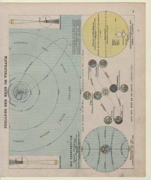
Stellung der Erde im Weltraum
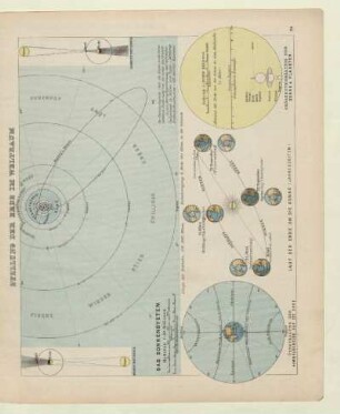
Stellung der Erde im Weltraum
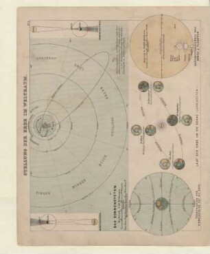
Stellung der Erde im Weltraum
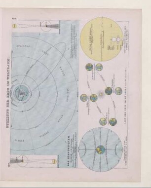
Stellung der Erde im Weltraum
Neuer Bildatlas, Erde und Weltraum. Unsere Erde
Karte: Vegetationsgebiete der Erde
Karte: Klimate der Erde
Physikalische Karte der Erde

Planet Erde aus dem Weltraum gesehen
Erde und Weltraum
Weltraum und Erde
Die Erde im Weltraum
Stellung der Erde im Weltraum
Stellung der Erde im Weltraum
Stellung der Erde im Weltraum
Stellung der Erde im Weltraum
Neuer Bildatlas, Erde und Weltraum. Unsere Erde
Karte: Vegetationsgebiete der Erde
Karte: Klimate der Erde
Physikalische Karte der Erde