Karte / Plan
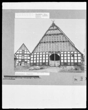
Brouillonkarte vom unteren Teil der Pottenhauser Heide, insbesondere der Teile für das Gut Iggenhausen und des Meyerhofs,. Inselkarte
- Reference number
-
D 73, 4/5368
- Dimensions
-
Maßstab: ca. 1:2.017
- Context
-
Allgemeine Kartensammlung (bisherige Kartei) >> 22. Tit. 4 (noch nicht klassifiziert) >> 22.10. Nr. 5201- 5400
- Holding
-
D 73 Allgemeine Kartensammlung (bisherige Kartei)
- Date of creation
-
(ca. 19. Jh.)
- Other object pages
- Provenance
-
Behörden, Institutionen, Einzelpersonen (Sammlungen)
- Delivered via
- Last update
-
05.11.2025, 4:30 PM CET
Data provider
This object is provided by:
Landesarchiv Nordrhein-Westfalen. Abteilung Ostwestfalen-Lippe. If you have any questions about the object, please contact the data provider.
Landesarchiv Nordrhein-Westfalen. Abteilung Ostwestfalen-Lippe. If you have any questions about the object, please contact the data provider.
Object type
- Karten / Pläne
Time of origin
- (ca. 19. Jh.)
Other Objects (12)

Brouillonkarte von einem teil der Salzuflener Feldmark, Karte A;. Inselkarte
Brouillonkarte Litt. C von einem Teil der Schwalenberger Feldmark; Inselkarte
Brouillonkarte Litt. D von einem Teil der Schwalenberger Feldmark; Inselkarte
Brouillonkarte Litt. E von einem Teil der Schwalenberger Feldmark; Inselkarte
Brouillonkarte der Osterheide;. Inselkarte

Meyerhof, Ecbert Felix gegen Albert von Exters Erben zu Iggenhausen - Schuldforderung
Brouillonkarte von einem Teil der Grundstücke der Dorfschaft Holzhausen; Inselkarte, Probekarte
Brouillonkarte der Schwalenberger Meiereien;. Inselkarte
Brouillonkarte der Meierei Falkenhagen. Inselkarte
Brouillonkarte vom Lopshorner (Forst); Inselkarte
Brouillonkarte der Alverdisser Gemeinheitsplätze;. Inselkarte
Meyerhof
Brouillonkarte von einem teil der Salzuflener Feldmark, Karte A;. Inselkarte
Brouillonkarte Litt. C von einem Teil der Schwalenberger Feldmark; Inselkarte
Brouillonkarte Litt. D von einem Teil der Schwalenberger Feldmark; Inselkarte
Brouillonkarte Litt. E von einem Teil der Schwalenberger Feldmark; Inselkarte
Brouillonkarte der Osterheide;. Inselkarte
Meyerhof, Ecbert Felix gegen Albert von Exters Erben zu Iggenhausen - Schuldforderung
Brouillonkarte von einem Teil der Grundstücke der Dorfschaft Holzhausen; Inselkarte, Probekarte
Brouillonkarte der Schwalenberger Meiereien;. Inselkarte
Brouillonkarte der Meierei Falkenhagen. Inselkarte
Brouillonkarte vom Lopshorner (Forst); Inselkarte
Brouillonkarte der Alverdisser Gemeinheitsplätze;. Inselkarte