Archivale
An den Mühlen
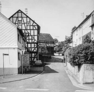
Längenprofil und Lageplan vom Hoppendamm bis zur Weseler Straße.
- Reference number
-
Slg-KUP, A 134,2,26
- Dimensions
-
Bi.: 45,5 x 54,6; Bl. 56,5 x 65,2
- Formal description
-
Papier leicht geknickt; eingerissen.
- Notes
-
Zeichner/Verfasser: Stä.
- Further information
-
Ausführung: Pause
Maßstab: 1:100, 1:1000
- Context
-
Karten und Pläne >> 01. Stadtdarstellungen >> 01.04. Straßen und Plätze
- Holding
-
Slg-KUP Karten und Pläne
- Indexentry person
-
Ho
Stä
- Indexentry place
-
An den Mühlen
- Date of creation
-
1935, 03. 22.
- Other object pages
- Provenance
-
. Städtisches Tiefbauamt
- Delivered via
- Last update
-
17.09.2025, 3:41 PM CEST
Data provider
This object is provided by:
Stadtarchiv Münster. If you have any questions about the object, please contact the data provider.
Stadtarchiv Münster. If you have any questions about the object, please contact the data provider.
Object type
- Archivale
Time of origin
- 1935, 03. 22.
Other Objects (12)

Mühle - untere Mühle an der Rednitz
An den Mühlen
Wasserstandsregulierung an Mühlen
Untersuchung des Wasserstandes der an der Mühle gelegenen Mühle
Teilabwicklung An den Mühlen
Mühle an der Klostermauer
Theater an der Mühle
Swing an der Mühle
Untere Mühle; Herborn, An den Mühlen 7, An den Mühlen 7A
Feststellung der Stauhöhe bei Mühlen und Anlagen; Veränderungen an Mühlen
Mühlen: Erwerbungen zu Mühlen
Die Mühle an der Panke
Mühle - untere Mühle an der Rednitz
An den Mühlen
Wasserstandsregulierung an Mühlen
Untersuchung des Wasserstandes der an der Mühle gelegenen Mühle
Teilabwicklung An den Mühlen
Mühle an der Klostermauer
Theater an der Mühle
Swing an der Mühle
Untere Mühle; Herborn, An den Mühlen 7, An den Mühlen 7A
Feststellung der Stauhöhe bei Mühlen und Anlagen; Veränderungen an Mühlen
Mühlen: Erwerbungen zu Mühlen